(Viber, Whatsapp, Cell) +977 9851022814

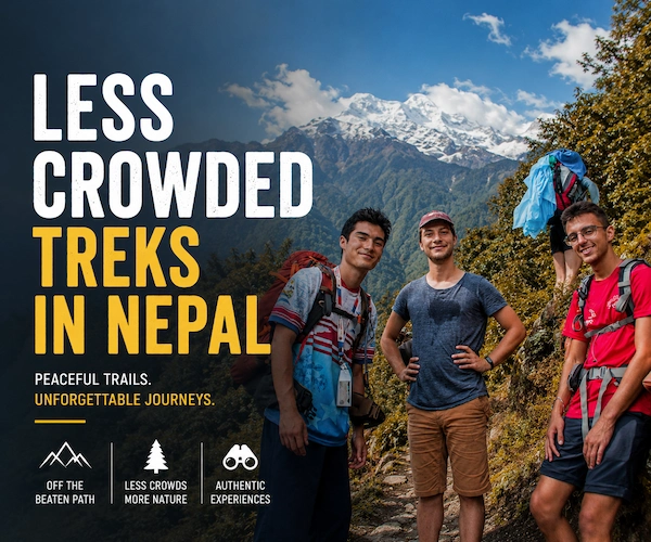
The Kanchenjunga Circuit Trek isn’t just another mountain adventure. It’s a three week long journey to the base of the world’s third-highest mountain, through one of Nepal’s most remote and offbeat regions.
We have guided over 500+ trekker’s on this route. Most of the trekkers arrive nervous, unsure if they can handle the altitude, the distance, the terrain. But by Day 10, standing at North Base Camp at 5,143 meters, they understand why we call this trek “life-changing.”
This complete guide breaks down every single day of the trek- elevation, walking time, difficulty, what you’ll see, what you’ll feel. Whether you’re planning your trip or just want to know what lies ahead, you’ll find everything here.
| Detail | Value |
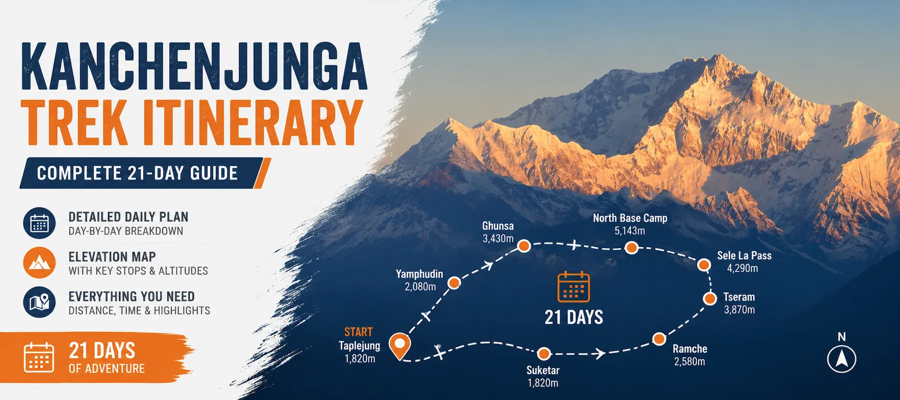
| Total Days | 21 days |
| Walking Days | 17 days |
| Rest/Travel Days | 4 days |
| Total Distance | 210–220 km |
| Highest Point | Kanchenjunga North Base Camp (Pangpema) – 5,143 m |
| Starting Altitude | Kathmandu – 1,350 m |
| Average Daily Walk | 5–8 hours |
| Trek Grade | Moderate-to-Difficult |
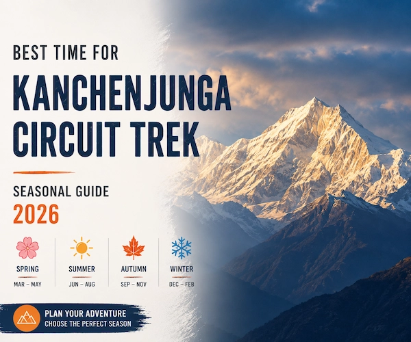
| Best Season | September–November, March–May |
Day 1: Drive from Kathmandu to Birtamode (1350m)
The adventure starts with a beautiful bus ride from Kathmandu to Birtamode. As you leave the bustling city behind, you’ll pass through lush landscapes and winding roads, experiencing the beauty of Nepal’s countryside. This will require a long drive and spend most of the day. It allows you to take a break as well as get ready for the trip to come.
The bus drives through the Terai area slowly heading towards the eastern hills. At nightfall you’ll reach Birtamode, a trading town on the Indian border. Get a good night’s rest, tomorrow you’re going up higher.
Day 2: Hike from Birtamode to Taplejung (1,820m)
The trip from Birtamode to Taplejung will be done on a shared bus in the morning. The drive is worth it as it takes you to a hilly area of Eastern Nepal. This is a shorter leg on the trip which passes through some more remote towns and villages, introducing you to the rural charm of the area. By the end of the day you will reach Taplejung where you will begin your trek.
It is a small hill town, your last place of comfort, your last place of supplies and your last place of communication before you enter the remote mountains of Taplejung. Here you can meet with your guide. Tonight I will learn to sleep and get ready for the journey.
Day 3: Taplejung to Sinuwa (2,498m) | 5-6 hours walking | +678m elevation
This is the beginning of your trekking journey. From Taplejung you will take a trek to the small village of Sinuwa in between terraced fields and green hills. The path is not too steep and will give you time to enjoy the gorgeous scenery and the joys of hiking.
The first day of trekking is surprisingly easy. The trail winds through a valley of a river where subtropical forest is found. You cross over terraced fields farmed by local farmers. The land is dotted with small villages. You are greeted by a nodding welcome from other trekkers as you go by. In the afternoon you reach the village of Sinuwa, where there are only 2-3 teahouses. You’re legs feel fresh. This is misleading. Save your energy.
Day 4: Sinuwa to Taplethok (2,725m) | 4-5 hours walking | +227m elevation
Following the breakfast a hike follows along to Taplethok. The trail passes through forests, rivers and beautiful local villages. You’ll be able to see the traditional villages and learn about the local culture and agriculture. In the late afternoon you will arrive at Taplethok where you will spend the night.
The climb is gradual and not too steep. The forest is still rather thick. Several streams to cross. The traditional stone houses now seem to be more common. Taplethok is on a ridge overlooking the surrounding valleys. It is definitely cooler than yesterday.
Day 5: Taplethok to Sekathum (3451m) | 56 hours walking | +726m elevation
We will walk today from Taplethok to Sekathum. The path slowly rises and provides some excellent views of the surrounding hills, too. You’ll cross a number of suspension bridges with exciting views down the rivers. The day is spent in a peaceful village called Sekathum, where you stay until early morning.
This is where the fun starts. The trail ascends more steeply. There are plenty of reasons to enjoy suspension bridges, including a great photo opportunity. The sound of the river will be heard below. Vegetation changes – rhododendrons appear (depending on the month of March – May). Late in the afternoon you arrive at a small quiet village called Sekathum at the river’s junction. So after four days you have climbed 2,100m!
Day 6: Sekathum to Amjelasa (3451m) | 5-6 hours walking (altitude data is the same as Sekathum)
The path then takes a steep turn to Amjelasa leaving Sekathum. The climb goes through dense woodland with a variety of animals and plants. Dense vegetation provides shade, and also a cooler climate which makes this a pleasant day of trekking. You’ll reach Amjelasa, a quiet but friendly outpost on the path by afternoon.
The forest is dense and attractive. The forest floor is blanketed with ferns. On a tree are mosses that attach themselves to the tree. Birds sing. Some portions of the trail are muddy. You’re moving at a slower speed, due to both distance and altitude. Amjelasa is a small town, but people in Amjelasa are friendly and welcoming. Rest well tonight.
Day 7: Amjelasa to Gyapla (4,050m) | 5-6 hours walking | +599m elevation
The trek today leads you further uphill as you head towards Gyapla. It gets cooler as it rises and the plants begin to become sparse. In the distance, you’ll catch a glimpse of snow-capped peaks as you go, and more traditional stone houses will be noticed as you rise. Gyapla is a serene village where you’ll spend the night.
The forest is merged with open slopes. More sky is visible now. In the distance, there are peaks covered in snow. Stone houses appear more frequently than usual. The air is fresh and light. This is normal and expected and you may notice slight shortness of breath. Gyapla is a peaceful place with the backdrop of mountains in the distance.
Day 8: Gyapla to Ghunsa (4,780m) | 6-7 hours walking | +730m elevation
The next day, it will be to an important village at higher elevation called Ghunsa. The trail continues to ascend. Of course, you’ll also see a significant difference in the landscape, with the mountains now taking center stage to the scene. Ghunsa is a bigger settlement, and a major trekking hub on the Kanchenjunga trail.
The climb to Ghunsa is quite steep. Your breathing is more difficult. Snow becomes visible. Alpine-like terrain prevails. Ghunsa is actually a village (many teahouses, local stores, yak herders, etc.). In 6 days you have climbed up 3,430 metres from sea level. The body is adapting. Tonight, you won’t be sleeping because of altitude; this is normal.
Day 9: Acclimatization Day in Ghunsa (3,451m—note: document states same as Day 5 and this information may be incorrect)
To adjust to the increasing altitude, you will spend a day acclimatizing in Ghunsa. Enjoy this day to explore the village, to meet people and also take some short walks around the area. The others will help you get ready for the higher altitudes to come. There will also be time to admire the magnificent mountains that surround Ghunsa.
This day is NOT an option. Altitude sickness is a killer disease! Respect it. Go for a walk to local ridges. Explore the village. Talk to monks in the monastery. Eat extra meals. Drink water constantly. In your body, new red blood cells are forming. Let it work. Acclimatisation can be achieved through short walks at altitude, but no straining.
Day 10: Ghunsa to Khambachen (4,050m) | 6-7 hours walking
You will take to the trail again after a day’s rest to continue on to Khambachen. The hike takes you through rocky terrain and open valleys. The higher you ascend, the more stunning the scenery is going to be, and you will be able to see snow capped peaks and glaciers as well. This is a small settlement called Khambachen where you will sleep over.
Now, there are no more trees or plants except hardy grasses; it’s now a full alpine scene. Glaciers are visible. The Trail is on loose moraine. You walk slowly, saving your energy. Khambachen is located in a high valley amidst peaks. The air is thin. It is a sensation you feel in every breath.
Day 11: Khambachen to Lhonak (4,290m) | 6-7 hours walking
This is the Lhonak (or Lhona-ko), a high altitude remote village today. The land grows more hilly. This will be a beautiful journey to Kanchenjunga range, too. It’s a strenuous but rewarding walk; on reaching Lhonak you spend the night there.
Lhonak is at the edge of a glacier. It is a rugged and stunning landscape, including brown rocks, blue ice and white peaks. The air is light, thin. Stars make shadows at night. You now have an altitude of over 4,250 meters. Your body is trying to acclimatise. This is a very common occurrence with many trekkers and is not a cause for concern, as many will find themselves suffering from insomnia at this altitude. His most exciting day will be tomorrow.
Day 12: Hike to Kanchenjunga North Base Camp (5,143m) from Kathmandu for 8 hours
Today’s trek includes an excursion to Kanchenjunga North Base Camp, one of the highlights of the trek. This day will be spent hiking through moraines and, eventually, glacier trails as you approach the foot of the world’s third highest peak. So after spending some time at the base camp, enjoying the magnificent scenery, you will fly back to Lhonak for the night.
This is the moment. You wake early. It’s cold—below freezing. Breakfast is quick. Your guide gives you a packed lunch. The hike goes over a glacier. Walk over moraines, ice and boulder fields. The air is very thin. Each step requires effort. Your guide walks slowly – pole pole (slowly slowly).
Then as the morning wore on, you catch a glimpse of Kanchenjunga’s North Face. The height of the mountain is 8,586 m. At base camp, standing in front of 3,443 meters of rock and ice, your brain has a hard time grasping the magnitude. This mountain has claimed climbers’ lives. It demands respect.
Your base camp time is 30-60 minutes. Take photos. Sit quietly. Take in the moment. Then you go back down to Lhonak (approx. 3 hrs.). The fall isn’t as difficult on the lungs, but as difficult on the knees. At the end of the day, you will be at Lhonak, totally tired and thrilled.
Day 13: Back to Ghunsa (4,580m) | 3 hours walk | –1,585m (document shows other data)
Following the adventurous journey you will make your way back to Ghunsa. The down side of the descent is less difficult than the ascent, and you will have more time to enjoy the views and to take in the surroundings. After arriving back in Ghunsa, you can rest and recuperate from the trek at the high altitudes.
The descent is a monotonous, but safe, descent. The impact is absorbed by your knees. Trekking poles help. At around 9 a.m., you’ll reach Ghunsa. You’re happy, proud and grateful. You have been at an altitude of 5,143 meters. You’ve seen the third largest mountain from its tip. You are a great man.
Day 14: Selka Base Camp (2995m) to Ghunsa | 6-7 hours walking
Today, you will leave Ghunsa and trek towards Selela Base Camp. The trail takes you through high mountain passes, offering incredible panoramic views of the surrounding peaks. The next stop is a quiet place to spend the night called Selela Base Camp.
You now turn to the south Base Camp. This involves climbing over a number of high summits, the most difficult section of the hike. Its landscape is an alpine tundra. Above 4000m, over open ridges. The views are 360° and 360° around you. Prayer flags are flying in the wind. Needs attention and concentration.
Day 15: Selela Base Camp to Ramche (2,080m) | 7-8 hours walking
The trek from Selela Base Camp is towards Ramche. The trail continues to offer breathtaking views of the mountains and valleys. The country starts to become rugged and the elevation starts to be felt as you approach Ramche. Upon arrival, there is a chance to tour the area or to sleep so that the next day’s hike can be completed.
The way down to Ramche is a long and gratifying one. You descend 915 metres. The area transitions from alpine tundra to rocky slopes to forests. Vegetation returns. The air warms. In the afternoon, you arrive at Ramche, where you can view the South Face of Kanchenjunga and Yalung Glacier.
Day 16: Ramche to Cheram and Kanchenjunga South Base Camp (1,975m) | 5-6 hours walking
You will trek today to Kanchenjunga South Base Camp passing through the village of Cheram. The way is through breathtaking valleys and heads towards the base camp with delightful views of Kanchenjunga massif. Once you have explored the base camp, you’ll head back to Cheram for the night.
You’ve now seen both the North and South Base Camps. Very few hikers make it to both. This is an uncommon feat. The South Base Camp is a different viewpoint, steep and dramatic to the south face of Kanchenjunga. At the end of this circuit you’ll come back to Cheram for the night.
Day 17: Cheram to Trongding (1,500m) | 6-7 hours walking | –475m descent
Leaving Cheram behind, you will trek towards Trongding. The trail descends there, and with the lower elevation it is easier to walk. On the way down you will see beautiful forests and meadows, and will reach Trongding for the night.
The long fall is still on. You lose 475 meters. Forests return. Rivers appear. Birds sing. The air is warm. You are feeling the effect of the downhill walking on your knees. Nowadays, trekking poles are a necessity. Most trekkers will never see a place like Trongding; it is a small and remote village.
Day 18: Trongding to Yambudin
Today, you will be hiking from Trongding to Yambudin. The trail takes you through more forests and charming villages, with plenty of opportunities to interact with locals and observe the traditional way of life in the region. Yambudin is a picturesque village where you’ll spend the night.
The descent continues. This is where the forests are green, and there’s plenty of plant life. Small villages appear. Families are fed on terraced fields. Yambudin is a beautiful village with hospitable locals. You’ve come down from the high passes thousands of metres. Your body is trying to recuperate oxygen.
Day 19: Yambudin to Gopetar
This day you will keep going down, and walk from Yambudin to Gopetar. The trail gets easier as you descend and you will be treated to the variety of vista points along the way back down to the lower levels. Gopetar is a peaceful village where you’ll end your trek.
Last day of trek. The path is now quite easy, low elevation, gorgeous views and not too many changes in grade. You’re no longer breathing hard. Your body is healing. Then, in the late afternoon you arrive at Gopetar. You have finished your 17 days journey. You have reached a height of 5,143 metres. You have hit high passes. You’ve walked 210+ kilometers. You have completed the Kanchenjunga Circuit.
Day 20: Drive from Gopetar to Birtamode (8-9 hours drive).
Once you have walked through Gopetar you will then drive on to Birtamode. This trip leads you through the beautiful scenery of the Eastern region of Nepal, and offers you one last opportunity to appreciate the beauty of the region before you arrive at the busy town of Birtamode.
You get picked up in a Jeep and driven back to Birtamode – same road, but in the opposite direction. The ride is rough, slow and dusty. But you’re no longer thinking about the road! You’re thinking about the mountains, the people, the views and the achievement. Overnight in Birtamode.
Day 21: Drive from Birtamode to Kathmandu
You will end your adventure with a drive back to Kathmandu from Birtamode. The trip is a long one and it is time for reflection on the amazing experiences of the past three weeks in remote villages and at the base of Kanchenjunga. Once you reach Kathmandu you can enjoy the achievement of your trekking.
It’s late night in Kathmandu. After a month and a half of mountain living, the city feels like chaos. But you’re transformed. You have reached a height of 5,143 m. You’ve visited the world’s third-mountaintop from the base. You’ve walked through remote regions few outsiders visit e.g. walking for a long time in areas that are not visited by this much of your class. You have accomplished something that you will never forget.
This trek is rated Moderate-to-Difficult and one of the most offbeat trails in Nepal, but here’s what that really means:
FactorChallenge LevelAltitudeHigh (5,143m) – requires acclimatizationDistanceLong (210-220 km over 17 days)Technical Skills Low – no climbing equipment needed Terrain Mixed – forests, rocky slopes, glacier moraine Daily Walking Hours5-8 hours averageHardest DayDay 13 (the passes)
| Factor | Challenge Level |
| Altitude | High (5,143 m) – Proper acclimatization required. |
| Distance | Long (210–220 km over 17 trekking days). |
| Technical Skills | Low – No climbing equipment required. |
| Terrain | Mixed – Forest trails, rocky slopes, suspension bridges, and glacier moraine. |
| Daily Walking Hours | 5–8 hours on average. |
| Hardest Day | Day 13 – Crossing the high passes and reaching the highest section of the trek. |
The best time for this trek is from September to November. The weather conditions are perfect, and visibility is incredible.
You have to do a certain level of exercise in order to complete this trek smoothly. Here’s what we tell every trekkers who are planning this Kanchenjunga Circuit Trek:
Tips: If you can easily hike for 6+ hours with 10-15kg of backpack, then you can do this Kanchenjunga Circuit Trek comfortably.
1. Climbing Too Fast
What happens: You reach Ghunsa feeling great, skip the acclimatization day, and summit North Base Camp on Day 9 instead of Day 10. Altitude sickness hits. You’re vomiting at Lhonak. You turn back.
Fix: Follow the itinerary exactly. Acclimatization days are sacred. Climb high, sleep low.
2. Overpacking
What happens: You bring 20 kg. Your porter struggles. You move slowly. Your knees hurt. You’re exhausted by Day 6.
Fix: Pack maximum 12-15 kg. Your porter carries 15-20 kg. Use a packing list.
3. Ignoring Altitude Sickness Symptoms
What happens: You have a headache on Day 8. You ignore it. By Day 9, you’re vomiting and confused. Altitude sickness is serious.
Fix: Talk to your guide immediately if you feel odd. Descend if needed. Diamox (medication) helps many people—ask your doctor.
4. Not Eating Enough
What happens: You skip meals because of altitude nausea. Your body weakens. You can’t walk.
Fix: Eat even when not hungry. Carbs and salt help. Eat breakfast completely, even if just bread and butter.
5. Dehydration
What happens: You drink 1-2 liters daily. Your urine turns dark. You develop a headache (could be altitude, could be dehydration—hard to tell).
Fix: Drink 3-4 liters daily. Boiled water is provided. Your guide will remind you. Listen.
A: Possibly. Mild altitude sickness affects around 30–40% of trekkers. With proper acclimatization and the planned itinerary, serious cases are uncommon. The acclimatization days in Ghunsa (Days 7 and 9) are especially important.
A: No. Solo trekking is not allowed because the Kanchenjunga region is a restricted area. A licensed guide is mandatory. Joining a group trek or hiring a private guide is the safest and most enjoyable option.
A: A group of 4–8 trekkers is considered ideal. It’s small enough for a personal experience while providing a good social atmosphere and shared support on the trail.
A: Your guide will organize a safe descent and, if necessary, emergency evacuation. Altitude affects everyone differently, so there is no shame in turning back. Your safety is always the top priority.
A: A common guideline is around 20% of your trek cost. Alternatively, many trekkers tip guides USD $10–15 per day and porters USD $7–10 per day, depending on the quality of service.
A: Yes. Early May is a great time to trek with blooming rhododendrons and pleasant temperatures. However, late May may bring pre-monsoon rain, so September to November generally offers more stable weather.
A: Yes, they are strongly recommended, especially during the long descents on Days 15–19. Trekking poles reduce pressure on your knees and improve stability on uneven trails.
A: Usually, yes. Although the trek crosses high mountain passes, the trails are generally wide and do not require technical climbing or walking along sheer cliffs. Most trekkers with a fear of heights complete the route comfortably.
A: Yes. When you follow the itinerary, acclimatize properly, listen to your guide, and respect the altitude, the trek is considered safe. Thousands of trekkers successfully complete the Kanchenjunga Trek every year.
Alliance Treks & Expedition Pvt. Ltd. Once is not enough for naturally and culturally Himalayas