(Viber, Whatsapp, Cell) +977 9851022814

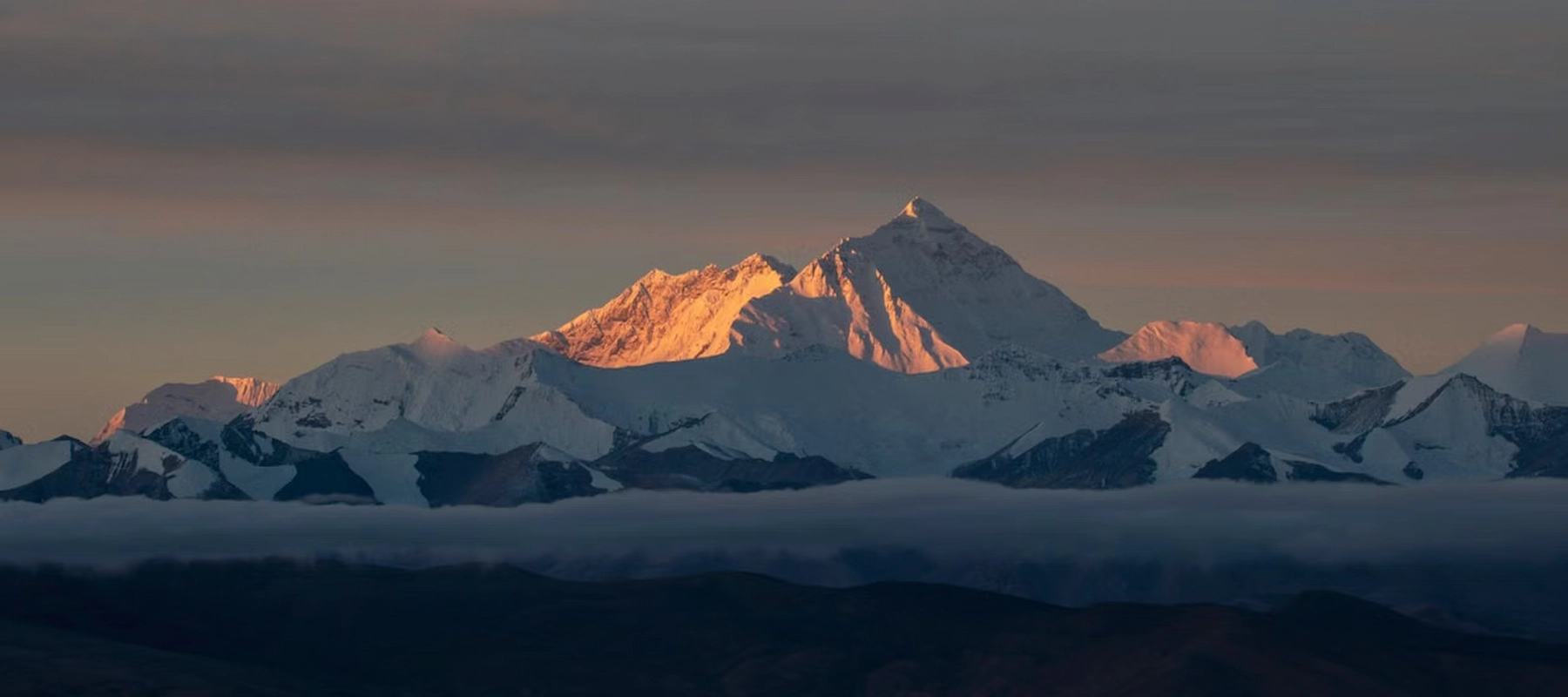
The Everest Base Camp Trek is the single most recognized trekking journey on Earth, drawing an estimated 30,000 to 40,000 trekkers to the Khumbu region every year. Over 12 days, the route climbs from Lukla at 2,860 meters through Sherpa villages, pine and rhododendron forest, and glacial terrain to reach Everest Base Camp itself at 5,364 meters, before a final push to Kala Patthar at 5,545 meters for the trek’s signature sunrise view of Mount Everest.
This guide goes well beyond a day-by-day itinerary. It covers every major stop on the trail in detail, the wildlife and vegetation you’ll pass through, Sherpa culture and religious sites along the way, local livelihoods, food and drink, altitude and acclimatization planning, the best photography locations, essential gear, required permits, and honest answers to the questions most first-time trekkers ask before booking.
| Detail | Information |
|---|---|
| Duration | 12 days (round trip from Kathmandu) |
| Max altitude | 5,545 m (Kala Patthar) |
| Everest Base Camp altitude | 5,364 m |
| Starting/ending point | Kathmandu (via Lukla flight) |
| Trip grade | Moderate |
| Group size | 1–15 |
| Accommodation | Teahouse/local lodge, twin-sharing |
| Best seasons | March–May, September–December |
| Permits required | Sagarmatha National Park entry, Khumbu Pasang Lhamu Rural Municipality fee |
| Ethnic community on route | Sherpa |
| Key highlight | Sunrise over Everest, Nuptse, and Lhotse from Kala Patthar |
The trek begins with a short, dramatic mountain flight into Lukla’s Tenzing-Hillary Airport, regularly cited as one of the world’s most thrilling airstrips due to its short runway and steep mountain approach. During peak season, flights typically route through Ramechhap airport after a 4–5 hour drive from Kathmandu, rather than departing Kathmandu directly. Lukla itself is a small trekking-focused town where crews assemble and the walk officially begins.
A gentle first day of walking follows the Dudh Koshi River through pine forest and small Sherpa settlements, crossing several suspension bridges decorated with prayer flags along the way. Phakding is a modest riverside village that serves as a comfortable, low-altitude introduction to teahouse life before the trail begins climbing in earnest.
Namche Bazaar is the cultural and commercial heart of the Khumbu region, built into a natural amphitheater on the hillside. Along the way, trekkers cross the Hillary Suspension Bridge and pass through Sagarmatha National Park’s entry checkpoint. Namche functions as both an acclimatization stop and a genuine town, with bakeries, gear shops, a Saturday market drawing traders from surrounding villages, and often the first clear glimpse of Mount Everest from the trail.
Rather than resting completely on the built-in acclimatization day, most itineraries include a short hike from Namche to the Everest View Hotel, one of the highest-altitude luxury hotels in the world. The panorama here takes in Everest, Lhotse, Ama Dablam, and Thamserku in a single sweep, and many trekkers also visit the Sherpa Culture Museum nearby before returning to Namche.
The trail descends to Phunki Tenga, then climbs through rhododendron forest to Tengboche, home to the largest and most important Buddhist monastery in the Khumbu. Set against a direct backdrop of Everest, Ama Dablam, and Nuptse, Tengboche Monastery is both a working religious site and one of the most photographed locations on the entire route.
Beyond Tengboche, the trail passes through Pangboche — one of the Khumbu’s oldest Sherpa settlements — before the landscape shifts from forest to open alpine terrain. Dingboche sits inside a wide valley protected by dry-stone walls originally built to shelter barley and buckwheat crops from wind, and it hosts the trek’s second acclimatization stop, often paired with a side hike to Nangkartshang viewpoint for panoramic views of Makalu, Ama Dablam, and Island Peak.
The trail climbs to Dughla before a steep ascent to a ridge lined with memorial cairns dedicated to climbers and Sherpas who lost their lives on Everest — a sobering, reflective point along the route. From here, the path follows the edge of the Khumbu Glacier to the small settlement of Lobuche, surrounded by increasingly stark, high-altitude terrain.
Gorakshep is the last settlement before Base Camp, reached by crossing rocky glacial moraine. From here, trekkers continue alongside the Khumbu Glacier to Everest Base Camp itself — during the spring climbing season, the site fills with colorful expedition tents, adding a rare, tangible connection to active mountaineering history. Most trekkers return to Gorakshep the same night after photographs and celebration at Base Camp.
Because Everest’s summit isn’t fully visible from Base Camp itself, most itineraries include a pre-dawn climb to Kala Patthar, the true highest point of the trek. Sunrise here lights up Everest, Nuptse, and Pumori in sequence, and it’s widely regarded as the best mountain panorama in the Khumbu.
The descent retraces much of the ascent route through Pheriche, Pangboche, Tengboche, and back to Namche Bazaar, before a final long trekking day back to Lukla. The return trip moves noticeably faster than the ascent, since altitude gain is no longer a limiting factor, giving trekkers a chance to see familiar villages and landscapes from a different perspective.
The trek passes entirely through Sagarmatha National Park, a UNESCO World Heritage Site protecting one of the most dramatic high-altitude ecosystems on Earth:
| Elevation Zone | Vegetation | Wildlife You Might Encounter |
|---|---|---|
| 2,600–3,000 m (lower forest) | Pine and blue pine forest, cultivated fields | Himalayan pheasants, various forest birds |
| 3,000–3,800 m (mid forest) | Dense rhododendron, fir, and juniper | Musk deer, Himalayan tahr |
| 3,800–4,500 m (sub-alpine) | Birch, dwarf rhododendron shrub | Danphe (Nepal’s national bird), occasional red panda sightings |
| 4,500 m+ (alpine/glacial) | Sparse moss, lichen, alpine grasses | Snow pigeon, Himalayan griffon vulture |
Spring (March–May) brings vivid rhododendron blooms across the mid-altitude forest sections, while the higher glacial zones near Lobuche and Gorakshep support almost no vegetation at all — a stark contrast that underscores just how much the landscape transforms over the trek’s 12 days.
The Everest Base Camp Trek runs directly through Sherpa homeland, a Tibetan-origin community renowned worldwide for high-altitude mountaineering skill and deeply rooted Tibetan Buddhist practice. Villages along the route — Namche, Khumjung, Pangboche, and Tengboche among them — showcase traditional stone architecture, prayer wheels at nearly every entrance, and daily religious life that continues alongside the trekking industry rather than existing separately from it.
Buddhist ritual is visible constantly on the trail: mani stones carved with sacred mantras line the paths (trekkers traditionally pass them on the left), chortens mark significant points along the route, and colorful prayer flags stretch across nearly every suspension bridge, believed to carry blessings into the wind with each flutter.
The Sherpa people are the predominant ethnic community throughout the Khumbu region, a Tibetan-origin group classified among Nepal’s Janajati (indigenous) communities rather than the traditional Hindu caste system. Historically, Sherpa livelihoods centered on yak herding, high-altitude trade routes with Tibet, and barley and potato cultivation suited to the region’s thin soil and short growing season.
Since Everest’s first successful summit in 1953, the Sherpa community’s role has shifted dramatically toward mountaineering and trekking tourism — as guides, high-altitude porters, teahouse owners, and expedition support staff. This shift has brought substantial economic benefits to the region, funding schools, health posts, and improved infrastructure largely through community and NGO efforts tied to mountaineering income, while Sherpa families have generally worked to preserve their language, monastic traditions, and cultural identity alongside this economic transformation.
Despite the remoteness of the route, teahouses along the way offer a genuinely varied menu:
| Food/Drink Category | Common Options |
|---|---|
| Staple meals | Dal bhat (lentils, rice, vegetables), fried rice, noodles |
| Tibetan-influenced dishes | Momos (dumplings), thukpa (noodle soup), Tibetan bread |
| Western-style options | Pasta, pizza, pancakes, porridge |
| Hot beverages | Black tea, milk tea, ginger-lemon-honey tea, coffee |
| Local specialty | Yak cheese and, at lower altitudes, locally brewed chhaang (fermented barley drink) |
As with most high-altitude Nepal treks, meal prices climb steadily the higher you go, since everything above Lukla arrives by porter or yak train. Dal bhat remains the most practical staple, since most teahouses offer unlimited refills, making it an efficient source of calories for demanding trekking days.
At a maximum altitude of 5,545 meters, the Everest Base Camp Trek carries a genuine, well-documented risk of altitude sickness, and this itinerary is specifically structured around managing that risk. Two dedicated acclimatization days are built in — one in Namche Bazaar (3,440 m) and one in Dingboche (4,410 m) — following the “climb high, sleep low” principle, where trekkers hike to a higher elevation during the day before returning to sleep at a lower one.
Standard precautions apply throughout: ascend gradually, stay well hydrated, avoid alcohol at altitude, and report early symptoms — headache, nausea, dizziness, or unusual fatigue — to your guide immediately rather than continuing. Licensed guides on this route are trained specifically to monitor these symptoms and adjust pacing or, if necessary, arrange descent or evacuation.
| Location | What Makes It a Standout Shot |
|---|---|
| Hillary Suspension Bridge | Dramatic bridge crossing draped in prayer flags above the Dudh Koshi gorge |
| Namche Bazaar | Amphitheater-style village setting with layered mountain backdrops |
| Tengboche Monastery | Monastery framed directly against Ama Dablam and Everest |
| Dingboche | Dry-stone-walled fields set against a wide alpine valley |
| Everest Base Camp | The Khumbu Glacier and expedition tents (in season) at the foot of Everest |
| Kala Patthar at sunrise | The trek’s signature shot — first light hitting Everest, Nuptse, and Pumori in sequence |
Sunrise at Kala Patthar is universally considered the best photo opportunity on the entire trek — arriving in the dark and positioning yourself before first light is essential, since the color shift across the peaks happens quickly in the first twenty minutes after sunrise.
| Category | Key Items |
|---|---|
| Clothing | Moisture-wicking base layers, insulating mid-layer, waterproof/windproof outer shell, warm hat and gloves |
| Footwear | Broken-in waterproof hiking boots, camp shoes, wool trekking socks |
| Sleep & comfort | Sleeping bag rated for sub-zero temperatures, basic toiletries, earplugs |
| Health & safety | Personal first-aid kit, water purification tablets or filter, Diamox or other altitude medication if prescribed |
| Practical extras | Headlamp, trekking poles, sunglasses rated for high-altitude UV, sunscreen, portable power bank, cash in small denominations |
Alliance Treks, like several established agencies, provides a returnable sleeping bag and down jacket as part of the package, reducing how much specialized cold-weather gear trekkers need to purchase before the trip.
| Permit | Purpose |
|---|---|
| Sagarmatha National Park Entry Permit | Required to enter the national park; checked at Monjo |
| Khumbu Pasang Lhamu Rural Municipality Fee | Local municipal entry fee supporting regional development |
Unlike some other Nepal trekking regions, the Everest Base Camp route does not currently require a separate TIMS card; both required permits are generally arranged directly by a registered trekking agency ahead of time.
It’s rated moderate to challenging. No technical climbing is required, but good fitness and stamina matter due to long walking days and sustained high altitude.
Spring (March–May) offers blooming rhododendrons and clear skies, while autumn (September–November) is generally considered the most stable and visually clear season.
Yes. It requires no mountaineering experience or technical climbing skill — reasonably fit, healthy trekkers can complete it with proper acclimatization and pacing.
Yes, particularly in peak season. An estimated 30,000 to 40,000 trekkers attempt the route annually, with up to 500 people on the trail on any given peak-season day.
Generally, yes. Everest Base Camp reaches significantly higher altitude and involves more trekking days than the shorter, lower-altitude Annapurna Base Camp route.
It’s possible, though most trekkers use a licensed guide for safety, altitude monitoring, and navigation, especially given the trek’s remoteness and altitude profile.
Trekkers may spot Himalayan tahr, musk deer, colorful pheasants, and occasionally the danphe, Nepal’s national bird, particularly in the mid-altitude forest zones of Sagarmatha National Park.
The Everest Base Camp Trek earns its legendary status not from a single moment but from the accumulation of an entire journey: a dramatic mountain flight, Sherpa villages steeped in Buddhist tradition, a genuinely diverse alpine ecosystem, and a final sunrise over the world’s highest peak that few other experiences can match. It demands solid fitness and patience with altitude, but no technical climbing skill — a combination that keeps it firmly at the top of serious trekkers’ bucket lists year after year.
Alliance Treks & Expedition Pvt. Ltd. has organized Himalayan treks and expeditions since 1992, and is registered with the Nepal Tourism Board, TAAN, and the Nepal Mountaineering Association. Our Everest Base Camp itinerary includes two full acclimatization days, government-licensed guides trained in altitude monitoring and wilderness first aid, and small group sizes capped at 15 people. The package includes round-trip Lukla flights, all required permits, and a returnable sleeping bag and down jacket kit, with transparent group-based pricing and no hidden costs.
Alliance Treks & Expedition Pvt. Ltd. Once is not enough for naturally and culturally Himalayas