(Viber, Whatsapp, Cell) +977 9851022814

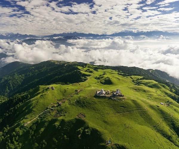
The Numbur Cheese Circuit Trek is a 16-day journey through the Ramechhap and Dolakha hills east of Kathmandu, climbing from the old Jiri trailhead at Shivalaya to the sacred lakes of Panch Pokhari at 4,607m before looping back down through Sherpa and Tamang villages to Thodung. Named after Nepal’s first yak cheese factory at Thodung and the unclimbed peak Numbur Chuli, this route sees very few trekkers. It combines forest trails, high pasture, a genuine pilgrimage site, and days of camping in country most foreign visitors never see. It suits trekkers who already have some multi-day trekking behind them and want distance from the main Everest and Annapurna trails.
Day 1 Arrival at Tribhuvan International Airport, Kathmandu (1,325m/ 4,344ft)
Day 2 Drive from Kathmandu (1,325m / 4,344ft) to Shivalaya (1,790m)
Day 3 Trek from Shivalaya to Khahare (1,216m/ 4,300ft)
Day 4 Trek from Khahare (1,216m / 4,300ft) to Pani Pakha (1,577m/ 5,190ft)
Day 5 Trek from Pani Pakha (1,577m / 5,190ft) to Mane Danda (1,900m/ 5,220ft)
Day 6 Trek from Mane Danda (1,900m / 5,220ft) to Panch Pokhari (4,100m/ 13,451ft)
Day 7 Trek from Panch Pokhari (4,100m / 13,451ft) to Tare Kharka (4,045m/ 13,123ft)
Day 8 Trek from Tare Kharka (4,045m / 13,123ft) to Ngeju Kharka (4,060m / 13,320ft)
Day 9 Trek from Ngeju Kharka (4,060m / 13,320ft) to Lahaksewar (2,665m)
Day 10 Trek from Lahaksewar to Kyama (1,400m / 4,593ft)
Day 11 Trek from Kyama to Gumdel (4,669m / 15,318ft)
Day 12 Trek from Gumdel (4,669m / 15,318ft) to Serding (3,421m)
Day 13 Trek from Serding to Lapchane (2,875m) via Thodung (3,030m / 30,300tf)
Day 14 Trek from Lapchane (3,030m / 30,300tf) to Those (1,755m)
Day 15 Drive from Those to Kathmandu (1,325m/ 4,344ft)
Day 16 Final Departure Katmandu International Airport (1,325m/ 4,344ft)
The Numbur Cheese Circuit Trek was easily one of the best experiences I had in Nepal. I loved the fact that the route felt quiet and authentic while still offering incredible Himalayan scenery. The villages, forests, mountain views, and local cheese culture all added something different to the journey. Sixteen days gave us plenty of time to enjoy the trek without constantly rushing. Race was a wonderful guide—friendly, caring, and knowledgeable. I would definitely recommend this trek to anyone wanting a more authentic Himalayan experience.
There were definitely some hard days on this trek, but every difficult climb came with something beautiful at the end. I really enjoyed the combination of nature, mountain scenery, and local culture. The cheese-making experience was a fun and unexpected part of the trip, and I loved trying the local products. Race was caring and knowledgeable and always made sure nobody was struggling alone. Overall, it was an amazing sixteen-day adventure.
What made this trek special for me wasn’t just the big mountain views. It was all the little moments along the way—having tea in a village, meeting local people, walking through the forests, and watching the changing landscapes. The sixteen-day itinerary gave us enough time to really settle into the rhythm of trekking. Race was friendly and easy to talk to, and he shared a lot of interesting information about the area. I enjoyed the journey very much.
I loved how peaceful this trek was. Most days we could simply walk and enjoy the sound of nature without seeing many other trekkers. The forests were beautiful, the villages were welcoming, and the mountain scenery was incredible. There were a few tiring days, but our guide Race kept encouraging us and made sure everyone was doing well. By the end, I felt very happy that I had chosen a less-traveled route.
I’ve trekked in Nepal before, but the Numbur Cheese Circuit felt completely different. It had a much more relaxed and local feeling, and we had plenty of opportunities to experience village life. The mountain views were spectacular, particularly on the clearer mornings. I also really enjoyed trying local cheese and learning how it is produced. Race was an excellent companion throughout the trip and made the sixteen days very comfortable.
This trek definitely gave my legs a workout, but I enjoyed every minute of it. The challenging sections made reaching the beautiful viewpoints even more rewarding. I loved the quiet trails, mountain scenery, and the feeling of being far away from busy cities. The local cheese-making experience was something I hadn’t expected and ended up being one of my favorite memories. Race was patient and encouraging whenever the trail got difficult.
For me, the best part of Numbur Cheese Circuit was getting closer to local mountain life. The scenery was obviously incredible, but I also loved staying around villages and seeing the daily routines of people living in the region. The trek felt genuine rather than overly touristy. There were some tough walking days, but our group enjoyed them together. Race was supportive, knowledgeable, and always happy to explain things along the way.
The scenery on this trek was simply amazing. I remember stopping several times just to enjoy the views because there was always another beautiful mountain or valley ahead. The trail also took us through peaceful villages and forests, which made the journey very enjoyable. I loved the local food and the chance to learn about traditional cheese production. Race was very helpful and friendly throughout the sixteen days. It was a fantastic experience.
I wanted to do something different from the usual Nepal trekking routes, and Numbur was a great choice. The trail was peaceful, the scenery was beautiful, and we had plenty of interaction with local communities. I really enjoyed the cheese-making aspect because it gave us a glimpse into everyday mountain life. Race was a very relaxed but professional guide and made sure everything went smoothly. I came back feeling like I had experienced a completely different side of Nepal.
I really enjoyed the slower pace of this trek. There was time to look around, take photos, talk with local people, and actually enjoy the surroundings instead of just focusing on reaching the next stop. The villages were lovely, and the Himalayan views were amazing. Some walking days were definitely tiring, but it was worth it. Race was an excellent guide and always checked on everyone. I would definitely choose this trek again.
This was one of those trips where you keep thinking about the experience even after coming home. The Numbur region is incredibly beautiful, and the combination of mountains, forests, villages, and local culture made the trek really special. I especially enjoyed learning about the local cheese production and seeing how people live in these remote communities. Race was always there when we needed help and kept the group in a good mood. I enjoyed every part of the journey.
I honestly thought sixteen days might feel too long, but by the end I wished we had a few more days. Every part of the trek had something different to offer. Some days were challenging, while others were perfect for simply enjoying the scenery and village life. The cheese-making experience was also a really nice touch and made the trek feel more personal. Race was patient and supportive throughout, and I really enjoyed having him as our guide.
I had not heard much about the Numbur Cheese Circuit before booking it, so I wasn’t sure what to expect. It turned out to be one of my favorite experiences in Nepal. The scenery was beautiful, especially the mountain views and quiet valleys, and I loved walking through the smaller villages. There was a really nice connection with local life that you don’t always get on the busier routes. Race was a great guide and made the whole trip easy and enjoyable.
I absolutely loved the Numbur Cheese Circuit Trek. It felt different from the beginning because the trail was peaceful and we got to spend a lot of time around local villages. The mountain scenery became more impressive every day, and I really enjoyed seeing the traditional cheese-making culture along the route. Sixteen days sounds long, but the trek passed so quickly. Our guide Race was friendly, knowledgeable, and always made sure we were enjoying ourselves.
What I enjoyed most about Numbur was the peaceful atmosphere. We weren’t surrounded by large groups of trekkers, so the experience felt much more natural. I loved seeing the local farms, walking through forests, and watching the landscape change as we gained altitude. The mountain scenery was incredible, but the small moments in the villages were just as memorable. Race was kind and knowledgeable and took very good care of us throughout the trek.
The Numbur Cheese Circuit lies east of Kathmandu in the Ramechhap and Dolakha districts, in the hill country between the Khimti Khola and Likhu Khola valleys. The trek falls within the Gaurishankar Conservation Area, a protected zone that borders Sagarmatha (Everest) National Park to the east and Langtang National Park to the west. Geographically, this puts the route in the same general belt of hills that the classic old Jiri-to-Everest trail passes through — in fact, Shivalaya, where this trek begins its walking days, is the same village where the original Jiri approach to Everest Base Camp starts. From here, though, the Numbur Cheese Circuit turns away from the Everest trail and climbs north toward Panch Pokhari, a group of sacred lakes sitting at 4,607m below the Numbur and Gaurishankar ranges, before looping back down to Those, near Jiri, to close the circuit.
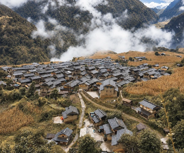
This is not a manicured, teahouse-every-few-hours trek. The lower section, between Kathmandu and Shivalaya, is a long road journey through Ramechhap’s terraced hillsides and market towns. From Shivalaya, the trail climbs steadily through pine and rhododendron forest, past scattered Sherpa and Tamang settlements, and into country that is genuinely thin on infrastructure. Between Khahare and Lahaksewar — roughly a week of walking — there are no real villages at all. Trekkers camp at high pastures (locally called kharkas) such as Pani Pakha, Mane Danda, and Ngeju Kharka, using basic stone-and-timber shelters where they exist and full camping equipment where they don’t.
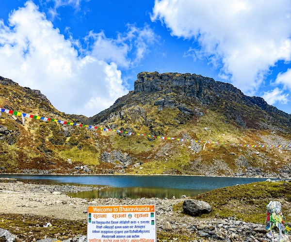
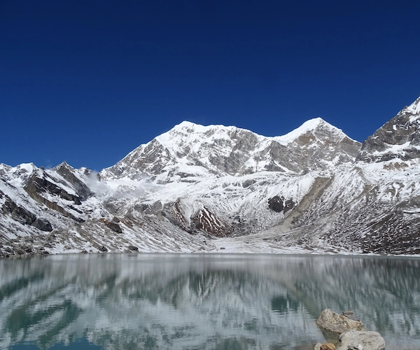
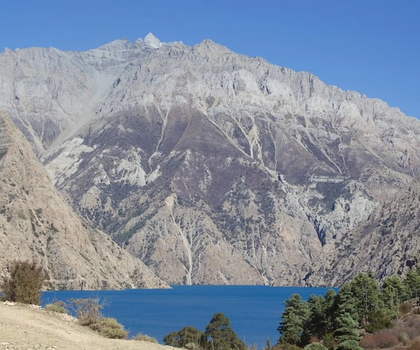
The character of the trek changes noticeably at Panch Pokhari itself. The five lakes sit in an open alpine bowl below the Jugal and Rolwaling ranges, and for Hindu and Buddhist pilgrims alike this is a place of real religious significance, not just a scenic stop. After Panch Pokhari the trail crosses a high ridge and begins a long, multi-day descent — first through more open kharka country, then back into forest and finally into inhabited villages again at Lahaksewar, Kyama and Gumdel. The final days, through Serding, Thodung and Lapchane, bring the trek to its cultural high point: Thodung’s monastery and Nepal’s first yak cheese factory, established in 1957, which gives the whole circuit its name.
Most Nepal treks funnel trekkers along one or two well-worn corridors. This one doesn’t. It shares its starting point with the historic Jiri trail but then breaks away entirely, spending the better part of two weeks in hill country that sees a small fraction of the trekking traffic of the Everest or Annapurna regions. The trek is built around a genuine pilgrimage site rather than a manufactured viewpoint — Panch Pokhari draws Hindu and Buddhist pilgrims, particularly around Janai Purnima in August, and the lakes carry that significance for local communities year-round. The Thodung cheese factory, meanwhile, is a working piece of Nepal’s agricultural history: it was the country’s first yak cheese operation, opened in the late 1950s, and it’s still tied to the local Sherpa economy today. Combine this with a route that alternates between full camping in uninhabited high country and simple homestays or lodges in the villages, and the result is a trek that asks more of trekkers logistically but gives back a much less filtered look at rural Sherpa and Tamang life in this part of Nepal.
The honest answer is that most trekkers choose this route because they’ve already done, or deliberately want to avoid, the busier circuits. If you want teahouses every two to three hours, hot showers most nights and a well-signed trail, this isn’t that trek — the Everest or Annapurna regions do that better. What the Numbur Cheese Circuit offers instead is genuine remoteness: roughly a week of the trek passes through uninhabited high country where camping is the only option, and the villages you do pass through, from Khahare to Gumdel, see very few foreign visitors in a season.
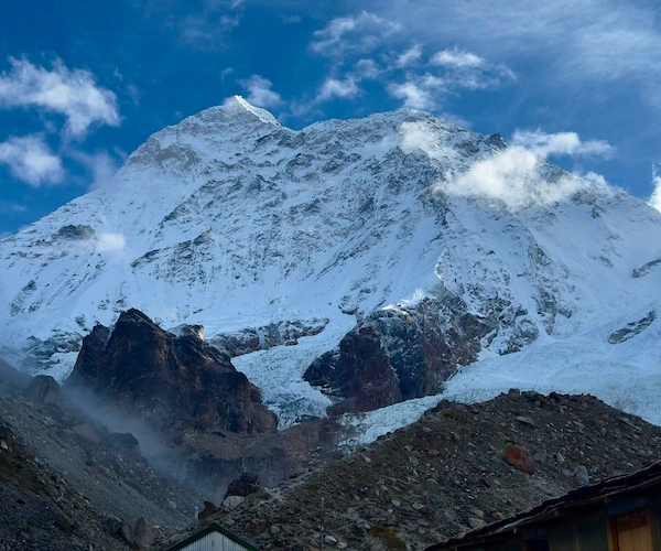
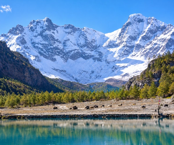
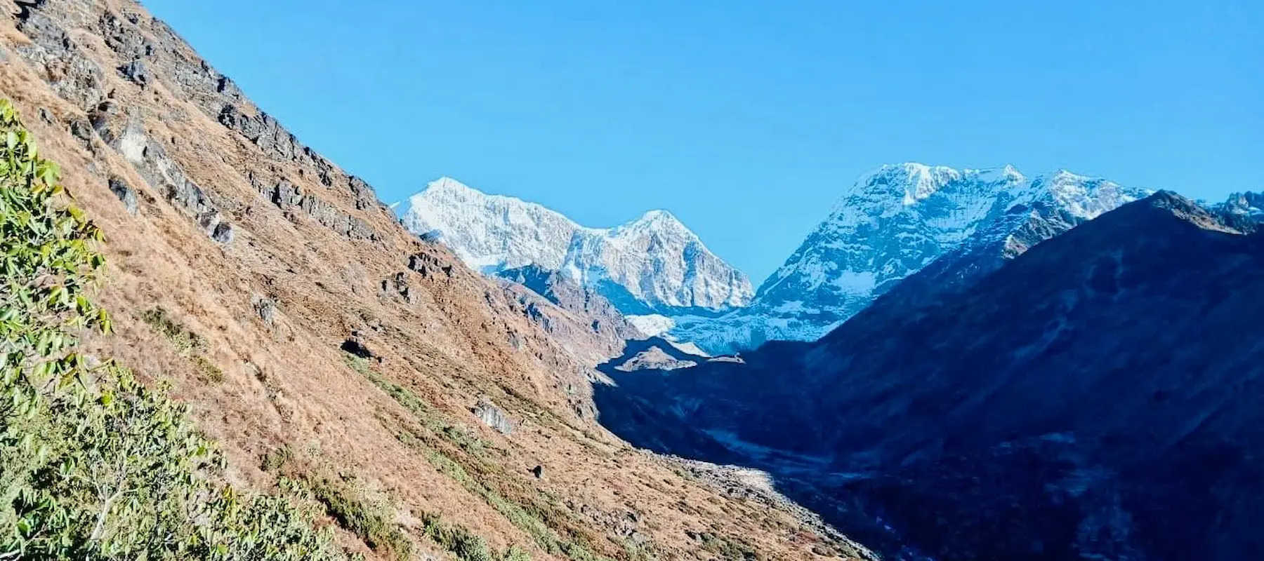
The scenery is a real draw in its own right. Gaurishankar and Numbur Chuli dominate the skyline for much of the trek, and Panch Pokhari itself is a striking, open alpine setting rather than a single viewpoint. The 16-day duration also means this isn’t a rushed trip — there’s time to properly acclimatise on the way up to 4,607m and to enjoy the descent through Sherpa and Newar villages rather than racing back to a road.
Where this trek is less suited is accessibility and comfort. It requires more self-sufficiency and camping tolerance than a standard teahouse trek, the trail is less consistently marked, and support infrastructure (mobile signal, charging, food variety) is thinner than on Nepal’s headline routes. For trekkers who’ve done a teahouse trek before and want something with more solitude and a stronger camping component, it’s a strong choice. For a first Himalayan trek, it’s worth thinking carefully about, which the next section covers.
This trek is best suited to trekkers who already have at least one multi-day Himalayan or high-altitude trek behind them, or who have solid multi-day hiking/camping experience elsewhere. It is not an ideal first trek in Nepal. The combination of sustained daily walking (often 5–8 hours), altitude up to 4,607m, several days of full camping in uninhabited terrain, and less predictable trail conditions means it asks more of trekkers than routes like Poon Hill or the standard Annapurna Base Camp trek.
Good fit for: trekkers with prior trekking or camping experience, those comfortable with basic camping conditions for extended stretches, hikers looking for a quieter alternative to the Everest or Langtang regions, and travellers who want a longer, more immersive itinerary rather than a short taster trek.
May find it challenging: complete beginners to multi-day trekking, anyone who needs daily hot showers, Wi-Fi or varied menus, trekkers uncomfortable with tent camping for several consecutive nights, and those with limited time who can’t commit to a full 16 days.
A reasonable base level of fitness is required — the ability to walk 5–7 hours a day on variable terrain, day after day, with a daypack. This trek is not technical (no ropes, no glacier travel), but it is physically demanding due to its length, altitude gain, and the remoteness of the middle section.
The Numbur Cheese Circuit is best described as strenuous rather than simply “moderate” or “difficult” — it sits above the standard teahouse treks of the Everest and Annapurna regions in terms of physical and logistical demand, mainly because of its length, the remoteness of its middle section, and the altitude reached at Panch Pokhari.
Daily walking hours: Most trekking days run 4–8 hours, with several consecutive 5–7 hour days through the high pasture section (Days 4–9) and one longer 6–7 hour day (Day 8, Tare Kharka to Ngeju Kharka).
Terrain: The route moves through pine and rhododendron forest, terraced farmland, open high pasture (kharka), and rocky ridge sections above the treeline near Panch Pokhari. Trail conditions are generally clear but less consistently maintained or signed than on Nepal’s major routes, particularly in the uninhabited stretch between Khahare and Lahaksewar.
Ascents and descents: The trek gains significant altitude steadily from Shivalaya (1,790m) to Panch Pokhari (4,607m) over five trekking days, then loses most of that altitude again over the following week on the way down to Those (1,755m). Several days involve sustained uphill or downhill walking rather than gentle undulation.
Altitude: At 4,607m, Panch Pokhari is high enough that altitude-related symptoms are a real possibility, and the itinerary’s gradual daily altitude gain in the days leading up to it is built around acclimatisation rather than speed.
Trail conditions: Expect a mix of forest paths, open ridge trail, and pasture track. Sections can be muddy in and after rain, and the trail is less trodden than the main trekking highways, so weather and recent conditions affect footing more noticeably.
Physical preparation: Trekkers should arrive with a solid base of cardiovascular fitness and some experience of multi-day walking with a daypack. Preparing with regular hikes, stair or hill training, and if possible a shorter trek beforehand is a sensible approach.
Weather considerations: Because the route spends extended time above 3,500m in exposed pasture and ridge terrain, weather can change quickly, and the trek is best undertaken outside the monsoon and deep winter windows (see Best Time to Trek below).
Spring (March–May): Generally the better of the two main seasons for this trek. Lower and mid-altitude sections are green, rhododendron forests are in bloom lower down, and daytime temperatures on the trail are comfortable. Visibility for the Gaurishankar and Numbur Chuli views is generally good, though afternoon cloud can build. Late spring (May) can bring the first pre-monsoon showers.
Monsoon (June–August): Not recommended for this trek. Rain makes the trail muddy and slippery, particularly in forest sections and on the exposed pasture stretches, leeches are common at lower elevations, and cloud cover regularly blocks mountain views. River crossings can also be more difficult. Note that Janai Purnima, the major pilgrimage festival at Panch Pokhari, falls in this window (typically around the August full moon), which does bring some local and pilgrim traffic to the lakes despite the weather.
Autumn (September–November): Widely considered the best season for this trek. Post-monsoon skies are generally clear, giving the most reliable mountain views of the whole year, trails have dried out from the monsoon, and temperatures are cool but manageable at altitude. This is also when trekking traffic across Nepal generally peaks, though the Numbur Cheese Circuit itself remains quiet compared to the main trekking routes.
Winter (December–February): Possible but demanding. Snow can settle on the high ridge sections and around Panch Pokhari, temperatures at the higher camps drop well below freezing at night, and camping conditions become considerably harder. Days are shorter, and some sections of trail may be less passable after heavy snowfall. Only experienced, well-equipped trekkers should consider a winter attempt, and it’s worth checking current trail conditions with Alliance Treks before booking a winter departure.
Accommodation on this trek is mixed, and trekkers should go in expecting a genuine camping component rather than a teahouse-only experience. Broadly:
Kathmandu and Shivalaya: Standard hotel or lodge accommodation with private or shared rooms, en-suite or shared bathrooms, and generally reliable electricity.
Khahare, Lahaksewar, Kyama and Gumdel: Basic homestays or simple lodges run by local families. Rooms are simple, bathrooms are typically shared and basic, and hot water (where available) is usually a bucket-shower arrangement rather than a hot shower head.
Pani Pakha, Mane Danda, Panch Pokhari, Tare Kharka and Ngeju Kharka: This is uninhabited high country with no permanent lodges, so trekkers camp using tents, mats and camping equipment carried by the crew. Some sites have basic stone-and-timber shelters that can supplement tents, but facilities are minimal — no showers, no charging points, and toilet facilities are basic or improvised.
Serding, Lapchane and Those: A return to simple lodge or homestay accommodation as the trail descends back into settled villages.
Electricity, charging and Wi-Fi: Available in Kathmandu and generally in Shivalaya and Those. Through the camping and homestay sections, charging is unreliable or unavailable, and Wi-Fi should not be expected at all once past Shivalaya. Trekkers should carry a power bank and be prepared to go without connectivity for the middle stretch of the trek.
Rooms: Twin-sharing is standard where rooms are available; tents are typically shared two to a tent during the camping sections, in line with standard Alliance Treks camping arrangements — please confirm exact configuration with the office.
Meals on this trek follow the same pattern as the accommodation — home-cooked or lodge food in the villages, and camp-cooked meals prepared by the trekking crew during the camping sections.
In Kathmandu and in villages with lodges, expect standard Nepali trekking staples: dal bhat (lentils, rice and vegetable curry), noodle and soup dishes, fried rice, momos where available, and simple breakfast options such as porridge, eggs and toast or Tibetan bread. In Lapchane specifically, the local Newar community means trekkers may come across more distinctly Newari dishes than elsewhere on the route.
During the camping days between Khahare and Lahaksewar, the trekking crew prepares meals from supplies carried in, generally centred on rice, dal, seasonal vegetables, noodles, soup, and simple breakfast items. Variety is more limited here than in villages simply because everything has to be carried.
Vegetarian and dietary needs: Dal bhat and most trekking staples are naturally vegetarian-friendly, and vegetarian diets are easily accommodated throughout. Vegan, gluten-free or other specific dietary requirements can generally be catered for with advance notice to Alliance Treks, but options will be more limited during the camping stretch than in Kathmandu or the larger villages. Trekkers with specific allergies or medical dietary needs should flag this clearly when booking.
Two permits are required for the Numbur Cheese Circuit Trek:
Purpose: Registers trekkers with Nepal’s tourism authorities for safety and monitoring purposes.
Mandatory: Yes, for this route.
Obtained: Through a licensed trekking agency (or the Nepal Tourism Board / Trekking Agencies’ Association of Nepal in Kathmandu).
Arranged by Alliance Treks: Yes, as part of standard trek preparation — please confirm current fee with Alliance Treks at time of booking, as TIMS fees are periodically revised.
Purpose: Entry permit for the Gaurishankar Conservation Area, the protected zone this entire trek passes through, covering conservation fees that support the local protected landscape between the Everest and Langtang regions.
Mandatory: Yes, for this route.
Obtained: Through a licensed trekking agency in Kathmandu, or at the conservation area entry point near Shivalaya.
Arranged by Alliance Treks: Yes — please confirm the current permit fee with Alliance Treks at time of booking, as conservation area fees are subject to periodic revision by the relevant authorities.
No restricted-area permit is required for this specific route, as it does not enter a government-restricted trekking area. Trekkers should always check with Alliance Treks for the latest permit requirements and fees before departure, as regulations in Nepal’s trekking regions are reviewed from time to time.
Alliance Treks & Expeditions has been organising treks and mountain journeys in Nepal since 1992, which means over three decades of working in exactly this kind of terrain — including quieter, less-documented routes like the Numbur Cheese Circuit, where good local knowledge matters more than it does on a well-marked, heavily trekked trail.
For a route like this one, that experience shows up in practical ways. It shows up in how the itinerary is paced, with enough time built in for gradual acclimatisation before reaching 4,607m at Panch Pokhari. It shows up in the guides and crew assigned to the trek, who know this specific area — including the uninhabited stretch between Khahare and Lahaksewar where there’s no lodge to fall back on and camp logistics need to be handled properly. And it shows up in the groundwork done before you even leave Kathmandu: permits (TIMS and the Gaurishankar Conservation Area Permit) arranged in advance, camping equipment organised and checked, and a realistic briefing on what this particular trek actually involves, rather than a generic pre-trek chat.
Because a meaningful part of this trek is genuinely remote — no phone signal, no roadhead, and camping as the only accommodation option for several days — safety-focused planning matters more here than on shorter, better-serviced routes. Alliance Treks’ guides carry standard first-aid provisions, are trained to recognise and respond to altitude-related symptoms, and maintain contact with the Kathmandu office throughout the trek for coordination if plans need to change due to weather or trail conditions.
Alliance Treks also works with trekkers individually rather than treating every group the same way. If you want a slightly different pace, an extra acclimatisation day, or adjustments around your own fitness level or schedule, that’s something the team can discuss and, where reasonable, build into your version of this itinerary. Support doesn’t stop once you’re on the trail either — from your arrival in Kathmandu through to your final departure, there’s a team behind the trek who know the route, know the region, and are reachable if something needs sorting out.
This isn’t a trek Alliance Treks runs constantly, and that’s part of the point — it’s a route for trekkers who specifically want to get away from Nepal’s busier trails, and having a company that’s operated in this country for over 33 years handling the logistics makes that kind of remote trekking considerably more manageable.
Kathmandu → Shivalaya → Khahare → Pani Pakha → Mane Danda → Panch Pokhari → Tare Kharka → Ngeju Kharka → Lahaksewar → Kyama → Gumdel → Serding → Lapchane (via Thodung) → Those → Kathmandu
The route runs as a loop rather than an out-and-back trail. It starts with a road journey from Kathmandu to Shivalaya, climbs steadily over five trekking days through forest and high pasture to the sacred lakes of Panch Pokhari at 4,607m, then descends over the following week through remote kharka country and back into inhabited Sherpa, Tamang and Newar villages, passing Thodung’s monastery and historic cheese factory before reaching Those and returning to Kathmandu by road.
Alliance Treks & Expedition Pvt. Ltd. Once is not enough for naturally and culturally Himalayas