(Viber, Whatsapp, Cell) +977 9851022814

The essentials:
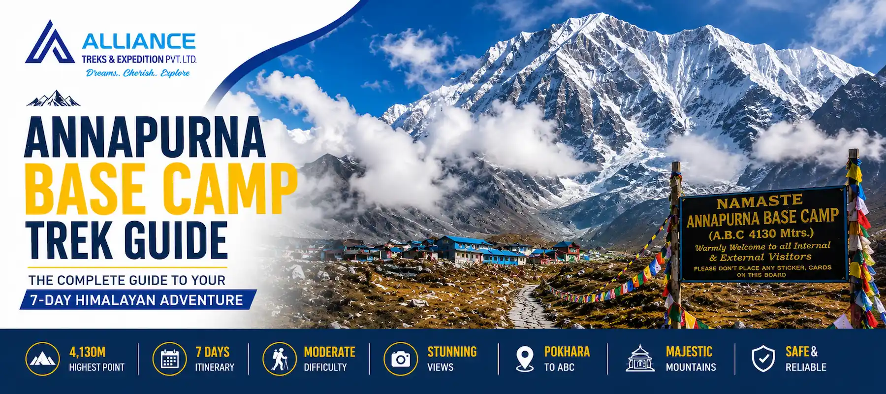
Duration: 7 days (4 days trekking up, 2 days at/near base camp, 1 day descending)
Highest point: Annapurna Base Camp at 4,130m (13,549 feet)
Starting point: Pokhara at 822m (2,694 feet)
Total elevation gain: 3,308m over 4 days (manageable with proper acclimatization)
Difficulty level: Moderate to challenging (altitude is the primary challenge, not technical skills)
Altitude sickness risk: 20-30% mild symptoms above 3,500m (lower than Everest BC due to shorter ascent)
Best season: October-November (autumn) and March-May (spring)
Group size: 1-100+ (popular trek, many groups)
Key advantage: The highest altitude most trekkers can safely reach without mountaineering training
Key challenge: Rapid elevation gain (3,308m in 4 days = fast ascent requiring careful acclimatization)
Unique feature: Only 7-day trek accessing 4,000m+ without technical climbing
We have guided 1,000+ Annapurna Base Camp treks for 34 years. This hiking trip is quite unique in its own right.
The majority of the 10-15 day 4,000m+ treks are available from various mountaineering companies.The 4,000m+ trekking companies offer a variety of treks, most of which last for between 10 and 15 days, with a few being even longer. The fastest safe route to the summit of Annapurna BC is 7 days, up to 4130m.
This rate provides both benefit (rapid ascent allows for a high altitude quickly) and difficulty (the rate of ascent elevates the risk of altitude sickness).
Day 1 to the subtropical foothills (2,165m), Day 3 to the Rhododendron forests (3,230m), Day 4 to the Alpine grasslands and glaciers (4,130m).
You can get 5 different climates in one week, more than most long trips.
ABC is above beginner level (Ghorepani at 3210m is beginner level, ABC at 4130m is beginner accessible with respect to the altitude).
Most people believe that they want mountaineering competences for 4000m. ABC shows you that you don’t… You need fitness, acclimatization, and the correct pace.
Kathmandu -> Pokhara (1 hour flight) -> trek (4 days) -> 4,130m. Total: 5 days from Kathmandu to reach the summit.
Compare: 14 days from Kathmandu to Everest BC. Manaslu requires 19 days. ABC is the fastest.
From Annapurna Base Camp, you can see:
These are not far-off opinions. You can see the fine detail on the snow, read the weather conditions in the clouds, and understand the mountain’s structure.
In contrast to the Manaslu challenge (technical pass, altitude, remoteness) or Everest (technical terrain, altitude, extreme cold), ABC’s challenge is all about managing altitude sickness.
This is perfect for testing your ability to go to higher elevations in a relatively safe environment.
| Day | From | To | Elevation | Daily Gain | Difficulty | Hiking Time |
|---|---|---|---|---|---|---|
| 1 | Pokhara | Chomrong | 2,165m | +1,343m | Easy–Moderate | 4–5 hours |
| 2 | Chomrong | Dovan | 2,600m | +435m | Moderate | 5–6 hours |
| 3 | Dovan | Deurali | 3,230m | +630m | Moderate–Challenging | 6–7 hours |
| 4 | Deurali | Annapurna Base Camp (ABC) | 4,130m | +900m | Challenging (Altitude) | 5–6 hours |
| 5 | ABC | ABC | 4,130m | Rest Day | Light Activity (Acclimatization) | 2–3 hours |
| 6 | ABC | Bamboo | 2,310m | −1,820m | Easy (Descent) | 5–6 hours |
| 7 | Bamboo | Pokhara | 822m | −1,488m | Easy (Drive + Descent) | 3 hours |
Elevation: 822m (Pokhara) – 2165m (Chomrong) Daily Gain: 1343m (the steepest single day gain on the trek) Trail Condition: Well-maintained with steep switchbacks, easy to moderate Hiking Time: 4-5 hours
What Happens:
Day 1 – Introduction and Warm-up. You begin in Pokhara, the city on the lake (822m), which is warm and humid. In just hours, you’re in the mountain forests.
The path is steep, going through rhododendron woodlands. Path well-maintained – steps cut in to hillside. There are numerous sources of water.
Chomrong (2165m) is located on a ridge above Annapurna South. It is a Gurung village with the traditional houses, people and the real mountain atmosphere.
Weather & Physical Experience:
Light: Indirect filtered daylight—light colors work best, but direct sunlight is not a problem.Humidity: High (60-70%)—fresh mountain air is best, but not oppressive.
Your body: You breathe much faster than at sea level. Legs are tired (1,343m gain is significant). By evening, most trekkers feel “I climbed a mountain”.
Sleep: Normal – sleep is not affected by the altitude, but is helped by physical exertion.
Acclimatization Impact:
Day 1 is NOT an acclimatization day! It’s ascent day. 1343m points for 1st day (significant ascent).
However, even though it is still not that high (2165m) it is not yet a time for acclimatization. Most trekkers are OK.
Practical Notes:
Elevation: 2,165 m Chomrong – 2,600 m Dovan Daily gain: 435 m (smallest daily gain – recovery day) Hiking time: 5-6 hours Difficulty: Moderate Trail condition: Mix of forest path and stream crossing
What Happens:
Day 2 is the “recovery day, disguised as hiking day. It is the least steep elevation profile (435m), which gives you the opportunity to rest and recover some of the effort you applied on Day 1 and still keep climbing!
Much of the day, the trail follows the stream of Modi Khola. There are several log bridges and stone steps over the stream. Rhododendron forests are very thick – they look like a tunnel filled with vegetation.
At midday, you arrive at Dovan (2600m). Quite a small town – not many teahouses, quiet.
Weather & Physical Experience:
Light: Shade—forests are damp, Retro-reflectivity: High, for forest trees to hold water, and Wind: Low, for forest trees require moisture
Your body: Legs are still fatigued from Day 1. Faster breathing than day 1, you are acclimating to the altitude. Some trekkers suffer from headaches (early symptom of altitude) to a mild degree.
Sleep: Better than Day 1 (more deep sleep due to less physical fatigue).
Altitude Awareness:
Altitude starts to become noticeable on day 2. At 2,600m:
This is normal. Your body is acclimatising.
Practical Notes:
The trail passes through forest, becoming increasingly alpine with some steep sections; the route is moderate to challenging with a significant rise in elevation from Dovan at 2600m to Deurali at 3230m, and a total hiking time of 6-7 hours.
What Happens:
Altitude really begins to make for a challenge on day 3. You’re leaving subtropical forests and entering the alpine zone.
The trail continues alongside the Modi Khola valley. Forest thins out, and rhododendrons are replaced by shrubs. Trees become stunted. Good things are beginning to happen on the elevation front.
Deurali is a small village and a pass at 3,230m. It is a transition zone; below is the forest world, and above is the alpine world.
Weather & Physical Experience:
Temperature: 10-16 °C in the daytime, 2-4 °C at night. Humidity: lower (50-60%)—air is crisp
Your body: You can tell right away that you are at altitude. Breathing is faster/deeper. Many trekkers experience:
These are normal altitude ailments and not indications of serious illness.
Acclimatization Reality:
Acclimatization is becoming an important subject on Day 3. You’ve climbed 1,408m in just 2.5 days – fast climbing.
Important: When symptoms of altitude are severe (e.g., headache, vomiting, confusion), descent is required. Don’t push through severe symptoms.
Not all symptoms are severe; for example, headache, fatigue, and decreased appetite are mild and controllable. Ibuprofen helps with headaches. Rest helps fatigue. Small, frequent feedings stimulate appetite.
Practical Notes:
Pack your bags and settle in for an adventure as you cross the deceptively simple, but steep, 5-6 hour trek to the peak of Deurali, at 4130m, where you’ll find a true mountain experience.
What Happens:
The objective of this trek is what lies at Annapurna Base Camp, and that’s the summit day (Day 4).
The track becomes entirely outside of the forest. You are in the alpin zone – little vegetation, plenty of views, thin air. Trail ascends gradually up through the alpine meadows to base camp.
At mid morning, it is clearly visible that the summits of Annapurna are visible—the Annapurna I, South and the Machapuchhre dominate the sky. The mountains are near.
The base camp (4130m) is located in high alpine country. In close proximity glacier/glacial lakes ( frequently covered with ice)/rocky tundra. It is really at a high altitude; oxygen levels are 60% less than at sea level.
Weather & Physical Experience:
Temperature: 5 to 12°C in the day, -5 to 0°C in the evening Humidity: Low (30-40%)—air is crisp and clear and thin
Your body: Today is the day of making altitude become a reality for you. Humans are subject to altitude effects:
It’s not failure – it’s ‘4,130m altitude reality’! Your body is at the limit of what unacclimatized humans can tolerate.
The Arrival Experience:
After 4 days of trekking to ABC, it is an emotional moment for most trekkers. The scenery is different: glaciers, bare rock, 8,000m peaks all around you. The air is so light it’s noticeable!
People generally say, “My body has just been completely worn out, but my mind was blown out with the view.
Acclimatization Status:
You have adapted well after acclimatising yourself to the environment for 4 days:
However: But: You’re not quite accustomed to the environment yet. You are about the “ceiling” of acclimatization. Day 5 (rest day) is a crucial day.
Practical Notes:
The starting point is Annapurna Base Camp (4130m), and the end point is the rest day at Annapurna Base Camp. The activity is to take a resting day with a small hike of acclimatization day (max. 2-3 hours), and the difficulty is Easy (rest focus).
What Happens:
Day 5 is NOT a rest day. It’s acclimatization day.
The schedule includes:
When you hike in the morning, the intensity of it is slightly higher (4,400m), so that means you are going to acclimatize your body, and then sleep at the lower elevation (4,130m) and it is much easier for you to sleep with the oxygen.
Physical reality at Base Camp:
Your body is at: 4,130m height and you are experiencing:
This is normal. You’re functioning at the limit of altitude tolerance. Your body is fine but not comfortable.
The Experience:
So, day 5 is often the most memorable, not because he or she is feeling better but because he or she is setting and experiencing it.
You are at 4,130m, amongst 8,000m peaks. The south side is dominated by Annapurna I. The sacred mountain, Machhapuchhre (the “sacred mountain”) rises to the east. Camp is surrounded by glaciers.
The light is strong – the sky is deep blue (less atmosphere to scatter light). Warm sun, cold air—15-20°C difference between warmth in sun and shade.
Many hikers have said “I was not very comfortable, but I was awestruck by the beauty.
Optional Activities:
Important Notes:
Descent from elevation ABC 4,130m to bamboo 2,310m with major descent, with hiking time of 5-6 hours and ease of descent.
What Happens:
The 6th day will be a rapid descent day. You summit over a fifth of the mountains you climbed over 4 days in one day, a 1,820m descent.
The path plunges down through alpine meadow, and then into rhododendron woodlands. For every 100m dive, the amount of oxygen you receive boosts by 1%.
The gap between Pokhara and Bamboo settlement (2,310m) is about half the distance. It is at a nice height, “mountain” but not too high, comfortable.
Physical Transformation:
Descent is a great adventure. With each 500m descent:
Why Rapid Descent Works:
Actually, the very rapid descent at 4,130m is a therapeutic one:
Importantly: It is OK to go from 4,130m to 2,310m in one day because you have acclimatised. It could be hazardous if you descended this speed without acclimatizing (rapid pressure change).
Practical Notes:
Elevation: Bamboo 2,310m → Pokhara 822m Daily Loss: 1,488m Activity: 3-hour descent + vehicle drive Difficulty: Easy Trail Condition: Steep downhill through forests
What Happens:
Day 7 is exit day. You descend 1488m towards Pokhara, and then drive back to Kathmandu or onward.
Descending route is simple (steep but clear) through forests. Arrive in Pokhara at noon.
At Pokhara, you will be at low elevation. Oxygen is abundant. Headache is gone. Appetite is strong. Recovery is felt right away.
Recovery Timeline:
Post-Trek Feelings:
Most trekkers experience:
The alternative route to Australian Base Camp (ABC alternative) is on the map. This route:
Route: Pokhara → Landruk (1,565m) → Siwai (1,530m) → Australian BC (2,060m) → rejoin main route at Jhinu Danda (1,780m)
Key Advantages: Lower crowd, lower Annapurna range views.
Key Disadvantages: Not as high as Annapurna Base Camp.
One reason most trekkers follow the main route, Pokhara–Chomrong–ABC, is that it is the highest route. Australian BC alternative is occasionally used for:
I rarely recommend the Australian BC alternative for first-timers. The main route is more direct and reaches the actual highest point (ABC at 4,130m).
| Day | From | To | Elevation | Daily Gain | % of Total Gain | Cumulative |
|---|---|---|---|---|---|---|
| 1 | Pokhara | Chomrong | 2,165m | 1,343m | 41% | 1,343m |
| 2 | Chomrong | Dovan | 2,600m | 435m | 13% | 1,778m |
| 3 | Dovan | Deurali | 3,230m | 630m | 19% | 2,408m |
| 4 | Deurali | Annapurna Base Camp (ABC) | 4,130m | 900m | 27% | 3,308m |
| 5 | Annapurna Base Camp (ABC) | Annapurna Base Camp (ABC) | 4,130m | 0m (Rest Day) | 0% | 3,308m |
Key Insight: Over half the elevation gain (41%) happens on Day 1. This is why many guides recommend starting slowly on Day 1, despite it being the largest gain.
Days 2-4 gain smaller amounts, allowing acclimatization between ascents.
October-November (Autumn) – BEST SEASON
Temperature:
Weather: Clear, dry, stable (80+ km views), low rates of altitude sickness, and crowds are very high. Best overall. Book 3-4 months advance.
December-February (Winter)
Temperature:
Weather: Clear, cold, except that for some areas, it is mostly overcast.Weather: Clear cold, though in some areas mostly overcast. Lower crowds. Very cold nights.
March-May (Spring)
Temperature:
Weather: Mixed (increasing clouds by May) Weather visibility: Good-excellent, (slightly increased due to humidity) Weather altitude sickness: 25-30% (mildly raised due to humidity) Weather crowd: High Recommendation: Good. Warmer than autumn. Rhododendrons start to flower late in April.
June-August (Monsoon)
Temperature:
Almost all visitors to the site are affected by altitude sickness (35-40%, higher with humidity), and there are virtually no crowds. Muddy, rainy conditions with inadequate sight. Just for genuine wannabes.
My opinion: October-November is definitely the best time of year. March, April, and May are good alternatives.
“If you are looking to book your journey, view our fully guided 7-Day Alliance Treks Annapurna Base Camp Package.”
| Factor | ABC Trek | Everest Base Camp | Manaslu Circuit | Kanchenjunga Trek |
|---|---|---|---|---|
| Maximum Elevation | 4,130m | 5,364m | 5,160m | 5,143m |
| Duration | 7 days | 14 days | 17 days | 21 days |
| Days to Reach Maximum Elevation | 4 days | 6 days | 11 days | 12 days |
| Altitude Sickness Risk | 20–30% | 50–60% | 45–50% | 40–45% |
| Difficulty | Moderate | Challenging | Very Challenging | Very Challenging |
| Remoteness | Low–Medium | Medium | High | Very High |
| Popularity | Very High | High | Medium | Low |
| Best For | Quick altitude experience | Everest enthusiasts | Remote Himalayan adventure | Extreme wilderness and isolation |
Headache is the most common symptom. Around 70% of trekkers above 3,500 meters experience a headache. Rest, proper hydration, and ibuprofen (400–600 mg, if suitable for you) can help. Symptoms usually improve after resting or descending to a lower altitude.
Yes. The Annapurna Base Camp Trek is considered one of the best first treks above 4,000 meters. Following a proper itinerary with enough acclimatization time—especially avoiding skipping the acclimatization day—gives most healthy trekkers an excellent chance of completing the trek safely.
Mild altitude sickness, including headaches, fatigue, and reduced appetite, is common and usually manageable. However, severe symptoms such as confusion, repeated vomiting, difficulty walking, or loss of coordination require immediate descent and medical attention. Proper pacing and acclimatization greatly reduce the risk.
The safest treatment is to descend immediately to a lower elevation. Most trekkers notice significant improvement after descending to places such as Deurali (3,230m) or lower. Do not continue ascending if symptoms worsen.
Yes, independent trekking is possible where regulations allow, but hiring a licensed guide is strongly recommended. A guide helps with navigation, recognizes altitude-related problems early, provides emergency support, and enriches the overall trekking experience.
Costs vary depending on your travel style. Budget treks generally range from NPR 8,000–15,000 (US$65–120), mid-range guided packages from NPR 20,000–40,000 (US$160–320), while premium or luxury experiences can exceed NPR 50,000 (US$400).
Yes. During the peak trekking seasons of October and November, the trail, teahouses, and Annapurna Base Camp itself can become quite busy. If you prefer quieter trails, consider trekking during the shoulder seasons.
It is not recommended. Reaching 4,130 meters too quickly significantly increases the risk of altitude sickness. A 7-day itinerary provides a much safer ascent and better acclimatization.
No. Teahouses along the route serve a variety of meals, including traditional Nepali and basic international dishes. Carrying a few energy bars or snacks for the trail is recommended, but you do not need to bring your own meals.
Alliance Treks & Expedition Pvt. Ltd. Once is not enough for naturally and culturally Himalayas