(Viber, Whatsapp, Cell) +977 9851022814

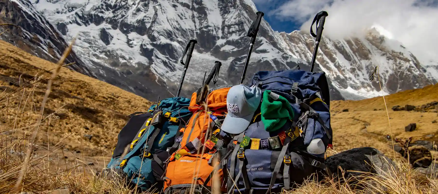
The Annapurna Circuit Trek is the route that arguably put Nepal trekking on the map internationally, and even in its shortened modern form, it still delivers everything that made it legendary: a genuine crossing from lush subtropical valley to high desert plateau, culminating in the crossing of Thorong La Pass at 5,416 meters — one of the highest trekking passes anywhere in the world. Where the classic circuit once took 18–21 days on foot from start to finish, road development over the past decade has opened a faster 10-day version that uses jeep transport on the lower approach and return legs, concentrating the trekking itself on the circuit’s most dramatic middle section.
This guide covers every stop along the trail in detail, the striking ecological transition from forest to desert, the Gurung and Manangi communities who live along the route, food and lodging, altitude and acclimatization planning around the pass crossing, the best photography locations, essential gear, required permits, and honest answers to what trekkers ask most before booking.
| Detail | Information |
|---|---|
| Duration | 10 days (Kathmandu to Pokhara) |
| Max altitude | 5,416 m (Thorong La Pass) |
| Starting point | Kathmandu (via Besisahar/Dharapani) |
| Ending point | Pokhara (via Jomsom) |
| Trip grade | Challenging |
| Group size | 1–15 |
| Accommodation | Local lodge/teahouse |
| Best seasons | March–May, September–December |
| Permits required | ACAP, TIMS |
| Ethnic communities | Gurung, Manangi (Nyeshang), Thakali |
| Key highlight | Crossing Thorong La Pass |
Besisahar to Dharapani (1,860 m) — The Road Gateway
The trek begins not with walking but with a scenic road journey — a local bus from Kathmandu to Besisahar followed by a shared jeep along mountain roads that trace the Marsyangdi River through terraced farmland, waterfalls, and traditional villages. Dharapani marks the official start of the trekking trail and the point where the classic Annapurna Circuit route is formally joined.
Chame (2,710 m) — Manang District Headquarters
The first trekking day moves through pine and fir forest, crossing suspension bridges and passing villages including Bagarchhap, Danaque, and Timang. As altitude builds, Lamjung Himal and Annapurna II begin appearing on the horizon. Chame itself, sitting at the district headquarters of Manang, offers a genuine small-town feel with hot springs nearby, a welcome comfort before the trail climbs further.
Upper Pisang (3,300 m) — Tibetan-Influenced Village Culture
The trail narrows through dense forest before opening into a wider valley with striking views of Annapurna II, Pisang Peak, and the surrounding snow-capped range. Upper Pisang is a traditional village with visibly Tibetan-influenced architecture and culture, marking the point where the trek’s cultural character shifts noticeably from the Gurung lower valley.
Manang (3,519 m) — The Circuit’s Cultural and Acclimatization Hub
Reached via the scenic high route through Ghyaru and Ngawal — widely regarded as offering some of the best mountain panoramas on the entire circuit, taking in Annapurna II, III, IV, Gangapurna, and Tilicho Peak — Manang is both the trek’s cultural centerpiece and its most important acclimatization stop. The town has grown a genuine tourist-oriented infrastructure of cafés, bakeries, and shops alongside its traditional monasteries, reflecting decades of trekking traffic through this key valley.
Rest Day in Manang — Preparing for the Pass
A full acclimatization day allows for short hikes to Gangapurna Lake, Ice Lake, or nearby viewpoints, alongside time to explore Manang’s monasteries and local culture. This day is not optional padding — it’s a critical physiological step before the altitude gain that follows over the next three days.
Yak Kharka (4,020 m) — Into Alpine Grazing Country
Leaving Manang, the trail climbs steadily through alpine meadows and yak grazing pastures, with vegetation thinning as elevation increases. Yak Kharka is a small seasonal-feeling settlement offering wide views of the surrounding peaks and valleys.
Thorong Phedi (4,525 m) — Base Camp for the Pass
A shorter but altitude-significant day crosses suspension bridges and rugged slopes to reach Thorong Phedi, the staging point for the pass crossing. Most trekkers spend the afternoon resting deliberately, since the following day begins before dawn.
Thorong La Pass (5,416 m) — The Trek’s Defining Moment
The circuit’s hardest and most rewarding day starts in darkness with a steady, sustained climb to the pass — one of the highest trekking passes in the world. The summit delivers a genuinely rare panoramic sweep spanning both the Annapurna and Dhaulagiri ranges simultaneously, a view that few single vantage points anywhere in the Himalayas can match.
Muktinath (3,800 m) — The Sacred Descent
From the pass, a long descent leads to Muktinath, one of the most significant pilgrimage sites in South Asia, sacred to both Hindus and Buddhists. Its 108 water spouts and naturally burning eternal flame make it a spiritually and visually distinct stop after the physical demands of the pass crossing.
Jomsom (2,743 m) — Gateway to Lower Mustang
The trail descends through the arid, windswept landscape of the Mustang region, passing traditional villages set against dramatic desert-like cliffs. Jomsom, the administrative center of Lower Mustang, marks the final trekking stop before road transport takes over for the return journey.
Jomsom to Pokhara — The Scenic Return
Rather than a return flight, this itinerary uses a jeep drive from Jomsom through Beni to Pokhara, tracing the Kali Gandaki Valley — the deepest gorge in the world — before the landscape transitions back into lush green hills. This overland finish makes the trek notably more budget-friendly than flight-dependent alternatives.
Few treks in Nepal cross as dramatic an ecological range in so short a distance — from subtropical forest to genuine high desert within roughly a week of walking:
| Elevation Zone | Vegetation | Wildlife You Might Encounter |
|---|---|---|
| 1,860–2,700 m (lower temperate) | Pine and fir forest, terraced farmland | Langur monkeys, pheasants |
| 2,700–3,500 m (upper temperate) | Rhododendron, birch, alpine forest thinning | Musk deer, Himalayan tahr |
| 3,500–4,500 m (sub-alpine/alpine) | Yak pasture, sparse alpine grass | Blue sheep (bharal), marmots |
| 4,500 m+ (high alpine/desert) | Minimal vegetation, rain-shadow scrub past the pass | Himalayan griffon vulture, occasional snow leopard (rare) |
The transition past Thorong La into the Mustang side is the trek’s most visually dramatic ecological shift — descending from snow and rock directly into the arid, rain-shadow terrain that characterizes the Kali Gandaki Valley, a landscape that looks and feels entirely different from the lush forest encountered on Day One.
The lower Marsyangdi valley around Chame and Bagarchhap is predominantly Gurung territory, while the upper valley around Manang is home to the Manangi (or Nyeshang) people, a distinct Tibetan-influenced community with their own dialect and a long-standing reputation for trade, historically holding special trading privileges that allowed them to travel and do business across borders more freely than most Nepali citizens.
Villages throughout the upper valley display visibly Tibetan Buddhist markers — prayer flags, mani walls, and monasteries — reflecting centuries of cultural and trade exchange across nearby Himalayan passes. On the Mustang side beyond Thorong La, Thakali cultural influence becomes more prominent around Jomsom, adding yet another distinct layer to a trek that crosses more cultural zones than almost any other route in Nepal.
The Gurung people predominate in the lower valley, an indigenous Janajati community historically tied to terraced farming and, notably, Gurkha military service in British and Indian regiments. Higher up, the Manangi community has built a distinct livelihood around trade — a legacy of historical trading rights that allowed them unusual mobility for cross-border commerce, which many families have since translated into successful business ventures both within Nepal and internationally.
On the Mustang side of the pass, Thakali communities take over around Jomsom, a group historically renowned across Nepal for trading acumen and highly regarded mountain cuisine. Since road access opened over the past decade, tourism has become an increasingly dominant livelihood source along the entire route — teahouse ownership, guiding, and portering now supplement or in many cases surpass traditional farming and herding income, particularly in well-trafficked hubs like Manang and Jomsom.
| Food/Drink Category | Common Options |
|---|---|
| Staple meals | Dal bhat, fried rice, noodles, Thakali thali (near Jomsom) |
| Tibetan-influenced dishes | Momos, thukpa, Tibetan bread |
| Western-style options | Pasta, pancakes, pizza (widely available in Manang) |
| Hot beverages | Black tea, milk tea, coffee, seabuckthorn juice (Mustang side) |
| Local specialty | Manang’s bakeries and cafés, Mustang apple products near Jomsom |
Because guided packages typically include only breakfast, lunch and dinner are paid for directly at teahouses — budget roughly $11 for lunch and $15 for dinner as trail prices rise with altitude, especially in the remoter stretches around Thorong Phedi.
At 5,416 meters, Thorong La Pass makes this one of the higher-altitude standard treks in Nepal, and the itinerary is built specifically around managing that risk. A dedicated acclimatization day at Manang (3,519 m) allows the body to adjust before the push toward Yak Kharka, Thorong Phedi, and the pass itself — a gradual three-day ascent from Manang to the pass base that follows sound altitude-gain principles.
Because Thorong Phedi to the pass and down to Muktinath is a single long 8–10 hour day covering nearly 900 meters of ascent followed by a steep 1,600-meter descent, this is the trek’s highest-risk stretch. Standard precautions apply: maintain steady pace, hydrate well, avoid alcohol at altitude, and report headache, nausea, or dizziness to your guide immediately — turning back from the pass attempt is always the safer option if symptoms are serious.
| Location | What Makes It a Standout Shot |
|---|---|
| Chame | Pine forest village framed against Lamjung Himal and Annapurna II |
| Ghyaru–Ngawal high route | Sweeping panorama of Annapurna II, III, IV, Gangapurna, and Tilicho Peak |
| Manang | Traditional village against a wide alpine valley backdrop |
| Gangapurna Lake | Turquoise glacial lake near Manang, a popular acclimatization-day side trip |
| Thorong La Pass summit | The trek’s signature shot — simultaneous views of the Annapurna and Dhaulagiri ranges |
| Muktinath | 108 water spouts and pilgrims against a mountain backdrop |
| Kali Gandaki Valley (Jomsom side) | Dramatic desert cliffs and the world’s deepest gorge |
The pass summit remains the definitive image of this trek, but the high route through Ghyaru and Ngawal is frequently cited by photographers as offering the single best mountain panorama of the entire circuit, rivaling the pass itself.
| Category | Key Items |
|---|---|
| Clothing | Thermal base layers, insulating mid-layer, waterproof/windproof shell, warm hat, insulated gloves |
| Footwear | Broken-in waterproof boots with ankle support, camp shoes, wool socks |
| Pass-specific | Headlamp (essential for the pre-dawn pass day), gaiters, sunglasses rated for high-altitude UV and snow glare |
| Sleep & comfort | Sleeping bag rated to at least -10°C |
| Health & safety | First-aid kit, water purification, altitude medication if prescribed |
| Practical extras | Trekking poles (valuable for the long pass descent), power bank, cash in small denominations |
A headlamp deserves particular mention — the pass-crossing day begins well before sunrise, and reliable lighting for the first hour or two of the ascent isn’t optional.
| Permit | Purpose |
|---|---|
| Annapurna Conservation Area Permit (ACAP) | Required for entry into the Annapurna Conservation Area |
| TIMS Card | Trekker registration and safety tracking |
Both permits are generally arranged directly by a registered trekking agency ahead of time, and a licensed guide is now a standard requirement for trekking in this region.
It’s rated challenging, primarily due to the Thorong La Pass crossing at 5,416 meters, which requires good fitness and proper acclimatization, though the shorter 10-day version with road transport is more accessible than the classic full-length circuit.
Yes. This itinerary uses road and jeep transport for the Kathmandu–Dharapani and Jomsom–Pokhara legs entirely, making it a genuine flight-free option, unlike routes such as Everest Base Camp that depend on a mountain flight.
Spring (March–May) and autumn (September–November) through December offer the most stable weather and clearest mountain views.
The Annapurna Conservation Area Permit (ACAP) and a TIMS card are required and are typically arranged through a registered trekking agency.
Yes, particularly from Manang onward. The itinerary’s built-in acclimatization day in Manang and gradual ascent to Thorong Phedi are designed to help reduce the risk.
The traditional full circuit took around 18–21 days entirely on foot. This modern 10-day version uses jeep transport on the lower approach and return legs, concentrating trekking on the circuit’s central section.
Yes, a licensed guide is currently required in Nepal for this route, both for safety during the pass crossing and for permit compliance.
Thorong La Pass reaches approximately 5,416 meters (17,769 feet) above sea level and is the highest point of the Annapurna Circuit Trek.
This 10-day itinerary starts in Kathmandu, travels by road toward Dharapani, crosses the Thorong La Pass, and continues through Muktinath and Jomsom before ending in Pokhara.
Accommodation is generally provided in local teahouses and lodges. Rooms are usually simple and comfortable, with basic facilities and communal dining areas.
Essential items include layered clothing, a waterproof jacket, warm gloves and a hat, sturdy trekking boots, a sleeping bag, sunglasses, sunscreen, a headlamp, trekking poles, a first-aid kit, and personal medications.
The Annapurna Circuit Trek compresses one of Nepal’s most complete Himalayan experiences into a genuinely achievable timeframe — Gurung farmland, Manangi trading culture, an alpine pass crossing among the highest in the world, a sacred pilgrimage site, and a return through the world’s deepest gorge, all within 10 days. It demands solid fitness and respect for the pass’s altitude, but rewards that effort with a diversity of landscape and culture that few other treks anywhere can match in the same span of time.
Alliance Treks & Expedition Pvt. Ltd. has organized Himalayan treks since 1990, and our 10-day Annapurna Circuit package is built around genuine budget efficiency — public bus and shared jeep transport rather than costlier private transfers or flights, keeping the trek accessible without cutting corners on safety. The package includes an experienced trekking guide from Kathmandu, all required ACAP and TIMS permits, a trekking map, and a returnable sleeping bag, down jacket, and trekking bag, with transparent group-based pricing starting at $550 per person for groups of 11 or more.
Alliance Treks & Expedition Pvt. Ltd. Once is not enough for naturally and culturally Himalayas