(Viber, Whatsapp, Cell) +977 9851022814

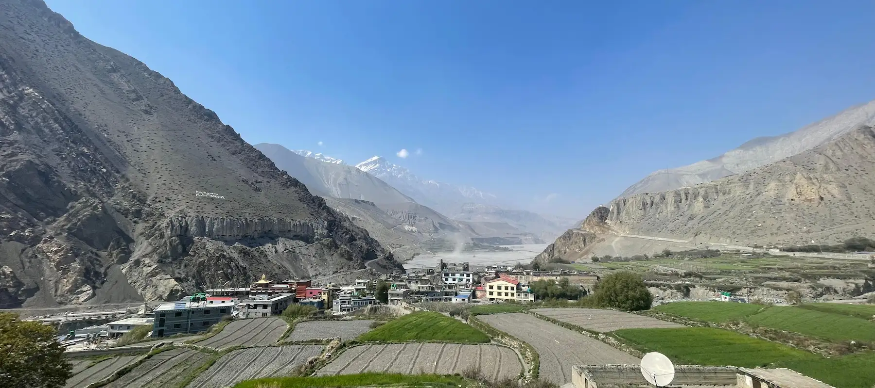
The Jomsom Muktinath Trek is an 8-day journey through Mustang, Nepal — one of the country’s most culturally and spiritually rich trekking routes. The trail leads to Muktinath Temple, a sacred pilgrimage site worshipped by both Hindus and Buddhists, and passes through villages with red-walled gompas, narrow stone lanes, and a strong Tibetan cultural presence that make it one of the most atmospheric stretches of trekking in Nepal.
We’ve guided trekkers on this route every year since 1990. Drawing on that experience, this guide covers everything you need to know: trail conditions, permit requirements, daily costs, and the cultural context that makes this trek special.
Key Facts
| Information | Details |
|---|---|
| Duration | 8 days (can extend to 9-10 days) |
| Starting Point | Jomsom (reached by 45-minute flight from Pokhara) |
| Ending Point | Muktinath Temple or return to Jomsom |
| Total Distance | Approximately 45-50 km |
| Highest Elevation | Muktinath Temple at 3,802 meters |
| Lowest Elevation | Jomsom at 2,743 meters |
| Difficulty Level | Easy to Moderate |
| Daily Walking Time | 4-6 hours per day (varies) |
| Best Trekking Seasons | September-October, March-May |
| Accommodation Type | Teahouse lodging (basic to moderate comfort) |
| Trek Type | Cultural and spiritual pilgrimage |
| Annual Trekkers | 3,000-4,000 (smaller than Everest or Annapurna routes) |
Muktinath Temple is why this trek matters. Sitting at 3,802 meters in the high Mustang Valley, this temple is sacred for both Hindu and Buddhist traditions.
Understanding the Trail
The Jomsom Muktinath trek follows well-established paths through the Kali Gandaki river valley and up to Muktinath Temple. The trail is clearly marked and heavily used by pilgrims and trekkers, which means it’s safe and easy to follow. However, the remote Mustang region ensures the trek remains authentic and culturally preserved.
Most sections are straightforward walking paths. There are no technical climbing sections, no rope work, and no mountaineering skills required. This is a trekking route, not a climbing route.
Trail Quality and Difficulty by Section
Jomsom to Marpha (~11 km, 4 hours)
Marpha to Tukuche (~8 km, 3-4 hours)
Tukuche to Koini (~10 km, 4-5 hours)
Koini to Kalopani (~12 km, 5 hours)
Kalopani to Tatopani (~9 km, 4 hours)
Tatopani to Lete (~11 km, 5 hours)
Lete to Ghasa (~6 km, 3 hours) Alternative route recommended
Ghasa to Muktinath (~8 km, 4-5 hours)
Why You Need Permits
The Jomsom Muktinath trek passes through the Mustang region, which is near the Nepal-Tibet border. Because of this sensitive location, the Nepali government requires special permits for trekking in this area. This is a security measure and registration system—nothing complicated or problematic. Permits are issued routinely, and checking is straightforward.
Permits You Must Obtain
You need two permits for this trek:
1. Annapurna Conservation Area Permit (ACAP)
| Detail | Information |
|---|---|
| Permit Name | Annapurna Conservation Area Permit (ACAP) |
| Cost | NPR 3,000 per person |
| Issued By | National Trust for Nature Conservation (NTNC) |
| Purpose | Conservation and management of the Annapurna Conservation Area |
| Validity | Valid for the duration of your trek within the conservation area |
| Requirement | Passport copy and passport-size photograph may be required |
2. TIMS Card (Trekkers Information Management System)
This is a trekker registration and safety tracking system.
| Detail | Information |
|---|---|
| Cost | NPR 2,000 (approximately USD $15) |
| Issued By | Nepal Tourism Board / NMA |
| Purpose | Trekker registration and safety information |
| Validity | Duration of your trek |
| Requirement | Passport information |
Total Permit Cost: Approximately NPR 5,300 total (USD $40-50)
Understanding Your Trek Schedule
The Jomsom Muktinath Trek is designed over 8 days with careful consideration for altitude acclimatization and physical pacing. Daily walking times range from 3-5 hours, making it accessible for most fitness levels. The schedule includes rest days and strategic stops for altitude adjustment.
| Day | Route |
|---|---|
| Day 1 | Drive to Pokhara (822m/2,696ft) |
| Day 2 | Fly to Jomsom (2,743m/ 8,999ft) & Trek to Marpha (2,660m/ 8,730ft) |
| Day 3 | Trek to Kagbeni (2,800m/ 9,200ft) via Jomsom (2,743m/ 8,999ft) |
| Day 4 | Trek from Jomsom (2,743m/ 8,999ft) to Muktinath (3,800m/ 12,467ft) |
| Day 5 | Full Day at Muktinath (3,800m/ 12,467ft) |
| Day 6 | Trek from Muktinath to Lupra Village (3,347m/ 10,880ft) |
| Day 7 | Trek from Lupra Village (3,347m/ 10,880ft) to Jomsom (2,743m/ 8,999ft) |
| Day 8 | Fly to Pokhara & Explore Pokhara City (822m/ 2,696ft) |
Weather: Stable, clear skies (90%+ clarity)
Temperature: Daytime 20-25°C, nights 10-15°C (comfortable)
Wind: Moderate, manageable
Rainfall: Low Chances
Trail Conditions: Excellent (dry, stable)
Crowds: Moderate (20-30 trekkers daily on trail)
Why Ideal: Best overall experience. Clear mountain views, comfortable weather, manageable crowds, reliable daily hiking.
Tip: Best Season for Jomsom Muktinath Trek
Weather: Generally clear (85% visibility average)
Temperature: Daytime 18-24°C, nights 8-14°C (pleasant)
Wind: Variable, occasional strong winds late May
Rainfall: Low until late May (5-10% probability)
Trail Conditions: Good (some wet patches from snowmelt)
Crowds: Light to moderate (15-25 trekkers daily)
Why Good: Rhododendrons may bloom on lower sections (April). Fewer trekkers than fall. Peaceful pilgrimage experience.
Watch Out: Late May sees increasing rain and afternoon thunderstorms. Stick to early May (1-20) if choosing spring.
Tip: Best time with clear visibility
Weather: Clear but cold (80% visibility)
Temperature: Daytime 5-15°C, nights -5 to +5°C
Wind: Strong, especially high passes (30+ km/h common)
Rainfall: Low (snow above 3,500m)
Trail Conditions: Icy above 3,000m (crampons sometimes needed)
Crowds: Minimal (5-10 trekkers daily)
Why Challenging: Extreme cold, trail icing, altitude + cold = harsh conditions. Only for experienced winter trekkers.
Best Month of Winter: February (warmest winter month, still manageable)
Tip: Good for experienced winter trekkers
Weather: Heavy rainfall (rain 15+ days per month)
Temperature: Warm but humid (20-25°C daytime)
Rainfall: Continuous afternoon showers, frequent all-day rain
Trail Conditions: Muddy, slippery, landslide risk
Clouds: Obscure views (60% of days)
Crowds: Minimal (few trekkers venture in monsoon)
Why Avoid: Mountain views disappear in clouds. Trails become muddy soup. The risk of landslides increases, which makes this season not worth the trekking experience.
The trek is easy to moderate in difficulty. You typically walk 4–6 hours per day, with altitude being the main challenge rather than technical terrain.
March–May and September–November are the best seasons. September–October generally offers clear skies and excellent mountain views.
The highest point is Muktinath at 3,802m (12,471ft). Proper pacing and hydration are important at this altitude.
Yes. You need the required Annapurna Conservation Area Permit (ACAP) and TIMS card, depending on the current trekking regulations.
The trek commonly takes around 7–10 days, depending on the starting point, transportation, and itinerary chosen.
Yes. It is suitable for beginners with reasonable fitness. Regular walking or hiking before the trek will make the journey more comfortable.
A licensed guide is recommended for safety, navigation, local information, and assistance with permits and logistics.
It is possible, particularly as you approach Muktinath. Walking slowly, staying hydrated, eating well, and allowing your body to acclimatize can reduce the risk.
You will generally stay in local teahouses and lodges offering basic but comfortable rooms and meals. Facilities become simpler at higher elevations.
Essential items include comfortable trekking shoes, warm layers, a rain jacket, sleeping bag, water bottle, sunscreen, sunglasses, trekking poles, and a basic first-aid kit.
Contact Alliance Treks
Ready to trek to Muktinath?
Alliance Treks has guided this route since 1990. We know every village, every teahouse, every spiritual significance. Contact Us
Alliance Treks & Expedition Pvt. Ltd. Once is not enough for naturally and culturally Himalayas