(Viber, Whatsapp, Cell) +977 9851022814

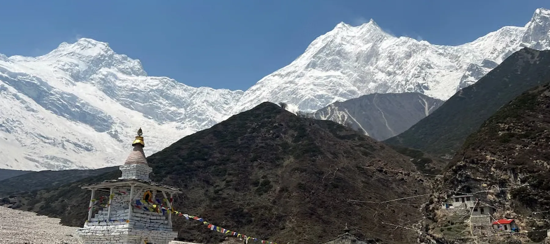
The Manaslu Circuit Trek is Nepal’s most compelling answer to the crowds of Everest and Annapurna. Over 17 days, this route circles Mount Manaslu (8,163 m) — the world’s eighth-highest peak — following the Budhi Gandaki River from subtropical valley floor to the trek’s defining challenge: the Larke La Pass at 5,160 meters. Because the entire region is designated a restricted area requiring special permits and a licensed guide, trail traffic stays a fraction of what you’ll find on Nepal’s headline routes, preserving both the landscape and the Tibetan-influenced village culture that makes this trek distinct. Other than the Manaslu Circuit Trek, trekking destinations like the Manaslu Tsum Valley Trek & Tsum Valley Trek are famous in this Manaslu region.
This guide covers every stop along the trail in detail, the wildlife and vegetation across its dramatic elevation range, the communities who live here and how they make their living, food and accommodation, altitude and acclimatization planning, the best photography locations, required gear, all five permits you’ll need, and honest answers to the questions trekkers ask most.
| Detail | Information |
|---|---|
| Duration | 17 days (Kathmandu to Kathmandu) |
| Max altitude | 5,160 m (Larke La Pass) |
| Mount Manaslu height | 8,163 m (world’s 8th highest) |
| Starting/ending point | Kathmandu |
| Trip grade | Challenging |
| Group size | 1–15 |
| Accommodation | Hotel in Kathmandu / teahouse on trail |
| Best seasons | Spring (March–May), Autumn (September–November) |
| Permits required | MRAP, MCAP, ACAP, TIMS, Tsum Nubri Rural Municipality |
| Licensed guide | Mandatory (restricted area) |
| Ethnic communities | Gurung, Nubri, Tibetan-influenced |
| Key highlight | Crossing Larke La Pass (5,160 m) |
The journey begins in Nepal’s capital, where the first two days cover arrival, a guided tour of UNESCO World Heritage Sites including Boudhanath Stupa, Pashupatinath Temple, and Patan Durbar Square, and — critically for this route — finalizing the restricted-area paperwork. Because Manaslu requires multiple permits that can only be issued through a registered agency, this preparation day isn’t filler; it’s a logistical necessity.
A long 9–10 hour drive takes trekkers west along winding mountain roads through Arughat and Soti Khola, transitioning from paved highway to rough dirt track as the route enters the Manaslu region. Machha Khola (“Fish River”) sits low in the Budhi Gandaki valley, and at under 900 meters it’s actually the lowest sleeping altitude of the entire trek — a useful reminder of just how much climbing lies ahead.
The first real trekking day follows the Budhi Gandaki through subtropical forest, past waterfalls and across suspension bridges. Jagat is a tidy stone-paved village that functions as the official entry checkpoint into the restricted zone — this is where permits are verified and where authorities will turn back anyone trekking without a licensed guide, making it a genuinely non-negotiable requirement rather than a formality.
The valley narrows considerably here, with the trail threading through steep gorges and bamboo groves. Deng marks the point where Tibetan cultural influence becomes visibly noticeable in architecture, dress, and religious markers along the path — a transition that continues steadily for the rest of the ascent.
One of the longer trekking days (8–9 hours) climbs through alpine forest with views opening toward Ganesh Himal. Namrung is where the shift becomes unmistakable: Tibetan-style flat-roofed houses, monasteries, prayer wheels, and chortens replace the Hindu-influenced hill architecture of the lower valley. It’s also the village that took direct damage in the September 2026 flood.
Samagaon is the trek’s cultural centerpiece and the point where Mount Manaslu itself begins dominating the skyline. A substantial high-altitude settlement surrounded by yak pastures and stone-walled fields, it’s home to the Nubri people and houses one of the region’s most significant monasteries. The itinerary includes a full acclimatization day here, typically used for a side hike to either Manaslu Base Camp (4,800 m) or Birendra Lake, a striking turquoise glacial lake fed directly by the Manaslu Glacier.
A short but important day brings trekkers to Samdo, the final permanent settlement on the route and a genuine Tibetan refugee village established by families who crossed the border decades ago. The landscape here is starkly barren and wind-scoured. A second acclimatization day allows a hike toward the Tibetan border ridge, where — weather permitting — trekkers can look directly into Tibet.
A steady climb brings you to Dharamsala, a basic, windswept collection of shelters that exists solely to stage the pass crossing. Facilities here are the most minimal on the entire route; most trekkers eat early and sleep early ahead of a pre-dawn start.
The trek’s defining day begins in darkness with a long, steady ascent to the pass. The reward at the top is a genuine panoramic sweep across Himlung Himal, Cheo Himal, Kang Guru, and Annapurna II — a view that spans two major Himalayan ranges at once. The descent from the pass is long and knee-punishing, dropping roughly 1,400 meters to Bimthang.
Emerging from the pass into Bimthang feels like arriving in a different country. Surrounded by glacial valleys and towering peaks, this broad meadow settlement marks the end of the trek’s hardest section and the beginning of a rapid, green descent.
The final trekking days descend through rhododendron forest and increasingly green terrain toward Tilije, then Dharapani — a well-known junction on the Annapurna Circuit. The contrast is notable: after two weeks on near-empty trails, trekkers suddenly rejoin one of Nepal’s busier trekking corridors, which underscores just how remote the Manaslu route really is.
The trek passes through the Manaslu Conservation Area, which spans an extraordinary elevation range from subtropical to high alpine:
| Elevation Zone | Vegetation | Wildlife You Might Encounter |
|---|---|---|
| 800–1,900 m (subtropical) | Sal forest, bamboo groves, terraced farmland | Langur monkeys, forest birds, butterflies |
| 1,900–3,000 m (temperate) | Rhododendron, oak, pine, alpine forest | Himalayan pheasants, musk deer |
| 3,000–4,000 m (sub-alpine) | Birch, juniper shrub, yak pasture | Himalayan tahr, blue sheep (bharal) |
| 4,000–5,160 m (alpine/glacial) | Sparse alpine grass, moss, lichen | Snow leopard (extremely rare), Himalayan griffon vulture |
The Manaslu Conservation Area is one of the few protected zones in Nepal with a confirmed snow leopard population, though sightings are exceptionally rare. Blue sheep are far more commonly spotted on the higher slopes around Samdo and Dharamsala, often in sizeable herds.
What makes the Manaslu Circuit culturally distinct is that it crosses a genuine cultural gradient rather than staying within one community. The lower valley around Machha Khola and Jagat is predominantly Hindu-influenced Gurung territory. At the same time, from Deng and Namrung upward, the region becomes solidly Tibetan Buddhist — a reflection of centuries-old trade and migration routes across the nearby Tibetan border.
In the upper Nubri valley, daily life follows visibly Tibetan patterns: prayer flags strung across ridges, mani walls carved with sacred mantras (traditionally passed on the left), chortens marking village entrances, and butter lamps burning in household shrines. Because the region was closed to foreign trekkers entirely until 1991 and remains restricted today, these traditions have experienced far less tourism-driven dilution than comparable communities in the Everest or Annapurna regions.
The Manaslu region is home to two main groups. In the lower valley, Gurung communities predominate — an indigenous Janajati group known throughout Nepal for Gurkha military service, with livelihoods traditionally built around terraced farming of millet, maize, and rice.
In the upper Nubri valley from Namrung to Samdo live the Nubri people, a Tibetan-origin community whose language, dress, and Buddhist practice closely mirror those across the border. Their traditional economy centers on yak herding, high-altitude barley and potato cultivation, and — historically — cross-border trade with Tibet, a trade route that has diminished significantly since the border closed to regular commerce.
Samdo has a distinct history: it was established largely by Tibetan families who crossed the border following political upheaval in Tibet, making it one of the more recent permanent settlements on the route despite its traditional appearance.
Since the region opened to trekking in 1991, tourism has become a growing supplementary income source — teahouse operation, guiding, and portering — though it remains less dominant here than in Khumbu or Annapurna, where trekking has more thoroughly reshaped local economies. Many families still rely primarily on herding and agriculture, with trekking income seasonal rather than year-round.
| Food/Drink Category | Common Options |
|---|---|
| Staple meals | Dal bhat (lentils, rice, vegetables), fried rice, noodles |
| Tibetan-influenced dishes | Momos, thukpa, tsampa (roasted barley flour), Tibetan bread |
| Western-style options | Pasta, pancakes, porridge, soup |
| Hot beverages | Black tea, milk tea, ginger-lemon-honey tea, Tibetan butter tea |
| Local specialty | Yak cheese and yak milk products, particularly in the upper valley |
Because Manaslu is more remote and less commercially developed than Everest or Annapurna, menus are noticeably simpler and food variety narrower, especially above Namrung. Dal bhat remains the most reliable option — locals have a saying, “dal bhat power, 24 hours,” and most teahouses offer unlimited refills. Expect meal prices to climb steeply with altitude, since everything above the road head arrives by porter or mule.
At 5,160 meters, Larke La Pass makes altitude management central to this trek’s safety planning. The 17-day itinerary builds in two dedicated acclimatization days — one in Samagaon (3,530 m) and one in Samdo (3,880 m) — which is more generous than many shortened 14-day versions of this route.
The Samagaon rest day is typically used for a climb to Manaslu Base Camp (4,800 m) or Birendra Lake, following the “climb high, sleep low” principle. The Samdo day allows a hike toward the Tibetan border ridge at a similar elevation. Both serve a genuine physiological purpose, not just sightseeing.
The pass crossing day is the trek’s highest-risk point: a long ascent from 4,460 m to 5,160 m followed by a steep 1,400-meter descent, often in cold and windy conditions. Trekkers should report headaches, nausea, or unusual fatigue to their guide immediately rather than pushing through, and should be prepared for the possibility that heavy snow can make the pass temporarily impassable.
| Location | What Makes It a Standout Shot |
|---|---|
| Budhi Gandaki gorge (Jagat to Deng) | Dramatic narrow gorges, waterfalls, and suspension bridges |
| Namrung | First clear Tibetan-style architecture set against Ganesh Himal |
| Samagaon | Mount Manaslu towering directly above a traditional stone village |
| Birendra Lake | Turquoise glacial water framed by the Manaslu Glacier |
| Samdo border ridge | Stark, barren high-altitude landscape looking toward Tibet |
| Larke La Pass summit | 360-degree panorama spanning Himlung, Cheo Himal, and Annapurna II |
| Bimthang | Broad glacial meadow ringed by peaks, especially striking at sunrise |
The pass summit is the trek’s signature image, but many photographers rate the Samagaon-Manaslu composition higher for sheer drama — few places in Nepal let you frame an 8,000-meter peak directly above a working traditional village.
| Category | Key Items |
|---|---|
| Clothing | Thermal base layers, insulating mid-layer, waterproof/windproof shell, warm hat, insulated gloves |
| Footwear | Broken-in waterproof boots with good ankle support, camp shoes, wool socks |
| Pass-specific | Microspikes or crampons (advisable for snowy Larke La conditions), gaiters, warm buff or balaclava |
| Sleep & comfort | Sleeping bag rated to at least -10°C, earplugs, quick-dry towel |
| Health & safety | Personal first-aid kit, water purification, altitude medication if prescribed, blister treatment |
| Practical extras | Headlamp with spare batteries, trekking poles (essential for the pass descent), high-UV sunglasses, sunscreen, power bank, cash in small denominations |
Trekking poles deserve particular emphasis on this route — the 1,400-meter descent from Larke La to Bimthang is long and steep, and poles significantly reduce knee strain. Alliance Treks provides a returnable sleeping bag, down jacket, and trekking bag as part of the package.
The Manaslu Circuit requires more permits than almost any other trek in Nepal — five in total:
| Permit | Purpose |
|---|---|
| Manaslu Restricted Area Permit (MRAP) | Required for the restricted zone between Jagat and Dharapani |
| Manaslu Conservation Area Project (MCAP) Permit | Entry to the Manaslu Conservation Area |
| Annapurna Conservation Area Project (ACAP) Permit | Required for the final descent section into Annapurna territory |
| TIMS Card | Trekker registration and safety tracking |
| Tsum Nubri Rural Municipality Entry Permit | Local municipal entry fee |
Critically, the MRAP cannot be issued to individuals — it must be arranged through a government-registered trekking agency, and a licensed guide is legally mandatory. Permits are checked at the Jagat checkpoint, where authorities will turn back trekkers without a guide regardless of what paperwork they hold.
| Aspect | Manaslu Circuit | Everest Base Camp | Annapurna Circuit |
|---|---|---|---|
| Duration | 17 days | 12–14 days | 10–14 days |
| Highest point | Larke La Pass (5,160 m) | Kala Patthar (5,545 m) | Thorong La (5,416 m) |
| Crowd level | Low (restricted area) | Very high | Moderate to high |
| Difficulty | Challenging | Moderate to challenging | Moderate |
| Permits needed | 5 (MRAP, MCAP, ACAP, TIMS, municipal) | 2 | 2 |
| Guide required | Mandatory by law | Recommended | Recommended |
| Cultural character | Tibetan-influenced, minimally commercialized | Sherpa, heavily tourism-shaped | Mixed, varied by section |
It’s a 17-day trekking route circling Mount Manaslu (8,163 m) in Nepal’s Gorkha district, crossing the Larke La Pass at 5,160 meters and passing through Tibetan-influenced villages in a government-designated restricted area.
It’s rated challenging — harder than Annapurna Base Camp and comparable to or slightly tougher than Everest Base Camp, mainly due to long trekking days, remote infrastructure, and the demanding Larke La Pass crossing.
Five: the Manaslu Restricted Area Permit (MRAP), MCAP, ACAP, TIMS card, and Tsum Nubri Rural Municipality entry permit. All must be arranged through a registered trekking agency.
No. A licensed guide is legally mandatory in this restricted area, and authorities at the Jagat checkpoint will turn back trekkers without one.
Yes. Nepal’s government now permits solo trekkers to obtain restricted-area permits, provided they book through a registered trekking company and trek with a licensed guide.
The 17-day itinerary includes two — one in Samagaon (3,530 m) and one in Samdo (3,880 m) — both used for higher day hikes following the climb-high, sleep-low principle.
Significantly. The restricted-area permit requirement and mandatory guide rule naturally limit numbers, making it one of Nepal’s quietest major trekking routes.
Spring (March–May) and autumn (September–November) offer the most stable conditions. Winter snow can make Larke La Pass impassable, and monsoon brings landslide risk to the lower valley.
The Manaslu Circuit Trek asks more of trekkers than Nepal’s headline routes — more days, more permits, more remote infrastructure, and a genuinely demanding pass crossing. In return, it offers something increasingly rare: a major Himalayan trek that still feels genuinely off the beaten path, with villages whose Tibetan Buddhist traditions haven’t been reshaped by decades of mass tourism. For trekkers who’ve already done Everest or Annapurna and want something wilder, or for first-timers with solid fitness willing to trade convenience for authenticity, it remains one of the most rewarding routes in the country.
Alliance Treks & Expedition Pvt. Ltd. has been guiding Himalayan treks since 1990 and has led over 8,000 adventures across Nepal’s remote regions. For a restricted-area route like Manaslu, that experience matters practically: they handle all five required permits directly, provide Nepal government-certified guides trained at NATHM, and cap group sizes at 15 for a more personal experience. Their 17-day itinerary includes two full acclimatization days rather than the compressed schedules some operators run, along with a porter shared between two trekkers, a returnable sleeping bag and down jacket, first aid provision, an emergency mobile phone, and a completion certificate — with transparent group-based pricing and no hidden costs.
Alliance Treks & Expedition Pvt. Ltd. Once is not enough for naturally and culturally Himalayas