(Viber, Whatsapp, Cell) +977 9851022814

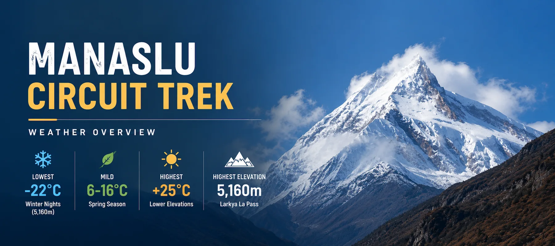
Temperature range: -22°C (winter nights at 5,160m) to +25°C (summer days below 2,000m)
Elevation span: 930m to 5,160m creates six different climatic zones simultaneously on the trek
Daily weather change: Can shift from sunny valley morning to freezing blizzard at Larkya La Pass in 6 hours
Most stable season: October-November (autumn)—clearest skies, most predictable
Most challenging season: June (peak monsoon)—constant rain, 15-20 rainy days per month, poor visibility
Most beautiful season: April (spring)—rhododendrons blooming, temperature 6-16°C in lower elevations, 0-5°C in higher elevations
Most severe season: January-February (winter)—daytime -2 to 6°C at high altitude, nighttime -15 to -20°C
Key reality: Weather on Manaslu isn’t just about comfort—it fundamentally affects trail difficulty, acclimatization speed, and whether certain sections are even passable.
I’ve guided 17 major treks in the Himalayan region over 34 years. Manaslu Circuit Treks weather is distinct for three reasons most travelers don’t realize until they’re on the trail.
Most treks span 2-3 climate zones. Manaslu spans six:
What this means: You’re simultaneously in a tropical jungle (1,000m area = warm rain) and arctic tundra (5,000m = freezing wind). Other trekkers on the same day experience completely different weather, 5km apart.
Most trekkers don’t predict this. The weather can change in this way in the Manaslu region:
This makes Manaslu unpredictable in ways that mess with trekkers’ assumptions.
Unlike Everest Base Camp (heavily developed infrastructure, rescue helicopters, weather stations), Manaslu is:
Weather events on Manaslu require self-sufficiency. You can’t “wait it out” in a village with 50 other trekkers and a restaurant. On Manaslu, you’re often alone with your guide, exposed, with only what you’re carrying.
This is why understanding Manaslu’s weather isn’t academic; it’s survival knowledge.
Understanding these zones explains why your Manaslu weather experience is completely different from someone on the same trek at different elevations.
Characteristics:
Weather experience: Walking through a warm, humid jungle. Humidity makes you sweat even in cool mornings. Afternoon temperatures can be hot (25°C+) by midday. Stream crossings are common because water from higher elevations flows down.
Trekker impact: This is a heat shock if coming from the city. Most trekkers underestimate this zone—they think Manaslu is cold mountains. The first two days might be hotter and more humid than expected.
Characteristics:
Weather experience: Comfortable hiking temperature. Mornings cool (5-8°C), midday mild (15-18°C). You’re out of jungle humidity but not yet in alpine air. Afternoon clouds are common—they build as day warms.
Trekker impact: This is where most trekkers start feeling “mountain.” Air is crisp. Breathing is slightly faster. Temperature is perfect for hiking without overheating.
Characteristics:
Weather experience: This is where “Himalayan weather” begins. Mornings are cold (0-5°C). Midday warms pleasantly (10-15°C). Afternoons often bring clouds/mist. Nights require a warm sleeping bag. Rhododendron blooms (April) are at this elevation.
Trekker impact: Altitude effects may start appearing. Sleep quality might be reduced due to a cold. Appetite might decrease. This is an acclimatization zone—the body begins adapting.
Characteristics:
Weather experience: Clear differentiation from temperate. Mornings are genuinely cold (subzero). Midday might reach 8-10°C with sun. Afternoons often bring clouds/wind. Nights are cold—sleeping bag becomes essential, not optional.
Trekker impact: Altitude sickness becomes possible. Sleep disruption is common. Appetite reduction is noticeable. Wind exposure increases. Weather can change rapidly—clear morning, afternoon clouds, evening clearing again.
Characteristics:
Weather experience: This is an extreme altitude. Daytime might be clear and “pleasant” (-2°C feels acceptable with sun and wind protection). Afternoon clouds come fast. Nighttime is genuinely dangerous in cold. Wind-chill makes -15°C feel like -25°C.
Trekker impact: Severe altitude effects possible. Larkya La Pass approach (Day 12) happens here. Weather can close the pass (visibility near zero, snow accumulation). Safety depends on the weather more than fitness.
Characteristics:
Weather experience: This is extreme. Temperature is dangerous for exposed skin (frostbite risk 15-30 minutes). Wind-chill converts -10°C real temperature to -25 to -30°C apparent. Visibility can drop to 10m in cloud/snow. Oxygen is 50% of sea level.
Trekker impact: This is a survival zone. Clear weather makes the pass safe and stunning. Poor weather makes the pass dangerous—potential whiteout conditions. Most pass disasters are weather-related (not fitness-related).
Most weather blogs talk about daily highs and lows. That misses the experience. Here’s what actually happens on Manaslu during a typical day at different elevations.
5:00 AM (wake-up time): Temperature 3-5°C. Sky is dark but stars visible. Breathing creates visible vapor. Your sleeping bag is essential—outside is genuinely cold. Teahouse provides hot tea (critical psychological and physical boost).
5:30 AM (start hiking): Temperature still 3-5°C. Air is crisp, clear, perfectly still. Hiking is pleasant—cool enough that exertion doesn’t overheat, but not so cold that you’re miserable. This is the best 90 minutes of the day—clear skies, cool air, nobody on the trail.
6:30-7:30 AM (mid-morning): Temperature rising toward 8-10°C. Sun illuminates peaks. Valley below is often full of clouds (inversion layer)—you’re hiking above the clouds. The view is extraordinary—mountain peaks emerging from white cloud ocean.
9:00 AM (later morning): Temperature 12-15°C. Sun is strong now. You might remove a layer. Clouds are building in valleys below but sky above is still clear. You can see 50+ km of mountain range.
11:00 AM (late morning): Temperature 15-18°C. This is warmest part of day coming. Humidity is still low. Wind is picking up—you feel it in open areas. Clouds are building more noticeably.
12:00-1:00 PM (afternoon begins): Temperature 18-20°C. Clouds begin forming around you. Visibility drops from 50km to maybe 10km as afternoon builds. This is when you want to be at tea stop resting, not ascending. Wind is now noticeable—makes hiking slower.
1:30-2:30 PM (peak afternoon): Temperature 20°C (peak). Clouds now obscure view completely. Visibility might be 1-2km in mist. Weather feels threatening—clouds dark, light grey. But this is normal—no rain coming typically, just afternoon cloud build. Wind is strong—you feel it pushing you.
3:00-4:00 PM (afternoon-to-evening): Temperature starting to drop (18°C). Clouds may part occasionally showing brief glimpses of sky. Wind remains strong. You’ve reached your teahouse/camp by now if following Manaslu schedule.
4:30-5:30 PM (evening builds): Temperature 12-15°C. Clouds begin clearing again as sun angle changes. Suddenly you have 10-15 minutes of crystal clear view as evening light hits peaks. Light is golden. Views are stunning. Then clouds roll back in. This 20-minute window is photographically perfect.
6:00-7:00 PM (sunset region): Temperature 8-12°C. Sky might be clear or cloudy. Sunset light is pink/orange on peaks (when visible). Teahouse dinner time. Dinner warms you and mentally ends the hiking day.
7:00 PM-7:30 AM (night): Temperature drops 3-5°C per hour. By 8 PM it’s 3-5°C. By 10 PM it’s 0-2°C. By midnight -2 to 0°C. By 4 AM it’s -5 to -8°C (coldest). Your sleeping bag becomes absolutely critical. Nights are long—sunrise is 5-6 AM in most seasons.
Key insight: You experience three completely different weather scenarios in one day:
This daily rhythm is so consistent that experienced guides plan around it: hike early when weather is best, rest midday during cloud buildup, enjoy evening light at camp.
The day you cross Larkya La Pass is different—extreme conditions, faster pace.
3:00 AM (wake-up): Temperature -18°C. You’re not sleeping—you’re lying in bag staying warm. Guides wake you for tea and breakfast at 4:00 AM.
4:00-4:30 AM (tea/preparation): Still -18°C. Guides prepare hot tea (essential—body needs warmth before starting). You eat something (hard to eat at this temperature). Getting dressed is frustrating—fingers are numb, zippers are stiff, you feel clumsy.
5:00 AM (start hiking): Temperature -15 to -18°C. Darkness is complete. Your headlamp is your only light. Wind is constant—you feel it pushing you sideways occasionally. Breath freezes on your goggles/face.
5:30-7:00 AM (ascent in darkness/early dawn): Temperature still -15°C. Pace is slow—everyone moves carefully in darkness, focused on footing. Altitude makes every step feel heavy. Breathing is rapid and labored. By 6:30 AM, the eastern sky begins to light up—first light appearing. This is psychologically huge—you can see where you’re going.
7:00-9:00 AM (sunrise to pass approach): Temperature rising toward -10°C. Sun briefly appears, then disappears into clouds that have built overnight. Visibility drops suddenly—from being able to see 5km to maybe 100m. Wind increases as the sun heats the air and creates wind shear. This is a dangerous zone—you push through clouds hoping visibility clears.
8:30-9:30 AM (pass crossing): Temperature -8 to -5°C. You reach the pass. If the weather cooperates (50% chance), visibility is 5-10km, and you can see peaks. If weather doesn’t cooperate, visibility is 50m and you can barely see 20 meters in any direction. Wind is howling—40-60 km/h typical, feels like it’s pushing you off the mountain.
9:30 AM-12:30 PM (descent in clouds): Temperature rising as you descend—each 100m descent drops temp by 0.6°C. Sounds backwards, but clouds trap you. Descent is steep and treacherous—snow/ice underfoot. Clouds obscure footing. Guides make you move carefully. Fear is real—you can’t see the cliff you’re descending past.
12:30-3:00 PM (lower descent into Bimthang): Temperature rising to 0-5°C. Clouds finally break. Suddenly, you see a valley below—you’ve been hiking blind for hours. Relief is enormous. Trail becomes less steep. Pace quickens. Oxygen feels less scarce.
3:00-5:00 PM (arrival in Bimthang): Temperature 8-12°C. You’ve descended 1,500m in one day. Your body is exhausted. The weather below is warm, almost hot after alpine cold. You’re soaked in sweat from exertion, but also frozen from morning cold. The contrast is jarring.
This single day shows Manaslu’s weather extremes: -18°C to +8°C in 12 hours, from darkness to blinding snow to clear sky, from near-unconscious cold to normal altitude.
January (Peak Winter)
| Factor | Details |
|---|---|
| Temperature (low elevation) | Daytime -2 to 8°C, nighttime -8 to -3°C |
| Temperature (high elevation) | Daytime -8 to -2°C, nighttime -20 to -15°C |
| Sky conditions | Crystal clear, extremely high visibility (80+ km) |
| Precipitation | Snow at high elevation (3,500m+), rare at low elevation |
| Wind | Constant, moderate to strong (15–30 km/h) |
| Trail condition | Snow and ice above 3,500m, dry below 2,500m |
| Trekker count | Extremely low (hardest season) |
| Best time of day | 9 AM to 2 PM (6-hour hiking window) |
Experience: Brutally cold. Nights are genuinely dangerous—hypothermia risk real. Daytime hiking is possible and beautiful—clearest views of entire year. But short daylight (sunrise 6:45 AM, sunset 5:30 PM = 11-hour day). Most trekkers can’t handle sustained cold.
February (Late Winter)
| Factor | Details |
|---|---|
| Temperature (low elevation) | Daytime 2 to 12°C, nighttime -5 to 2°C |
| Temperature (high elevation) | Daytime -5 to 2°C, nighttime -18 to -12°C |
| Sky conditions | Mostly clear, high visibility |
| Precipitation | Less snow than January; high passes get occasional snow |
| Wind | Moderate, consistent |
| Trail condition | Snow above 4,000m, trail clear below |
| Trekker count | Very low |
| Best time of day | 8:30 AM to 3 PM |
Experience: Slightly warmer than January—more tolerable. Still brutally cold at night. Daytime hiking is enjoyable if properly dressed. Larkya La Pass is still snow-covered but passable. Solitude is extreme—you see few other trekkers. Supplies at high-altitude teahouses may be minimal.
March (Early Spring)
| Factor | Details |
|---|---|
| Temperature (low elevation) | Daytime 8 to 18°C, nighttime 0 to 8°C |
| Temperature (high elevation) | Daytime 0 to 8°C, nighttime -8 to -2°C |
| Sky conditions | Mixed; morning clear, afternoon cloudy |
| Precipitation | Occasional rain at low elevation, snow at high (still winter-like) |
| Wind | Increasing; spring wind patterns begin |
| Trail condition | Snow melting; trails sometimes muddy below 3,000m |
| Vegetation | Rhododendrons starting to bloom (late March) |
| Trekker count | Increasing (season opening) |
| Best time of day | 7 AM to 3 PM |
Experience: Transition month—unpredictable. Some days feel like spring (warm, clear), others like winter (snow, cold). High altitude still has winter conditions. Low elevation becomes warm and humid. Rain appears in afternoons at lower elevations—not all-day rain, but heavy showers possible.
April (Peak Spring)
| Factor | Details |
|---|---|
| Temperature (low elevation) | Daytime 15 to 25°C, nighttime 5 to 12°C |
| Temperature (high elevation) | Daytime 5 to 12°C, nighttime -2 to 5°C |
| Sky conditions | Majority clear; afternoon clouds common |
| Precipitation | Rare rain; mostly dry month |
| Wind | Moderate spring winds |
| Trail condition | Completely clear; dry; perfect hiking |
| Vegetation | Rhododendron peak bloom (entire 2,500–3,500m zone is pink, red, and white with blooming flowers) |
| Trekker count | Very high (peak season alongside autumn) |
| Best time of day | 6 AM to 4 PM |
Experience: Best weather month for most trekkers. Clear skies, warm days, cold but not dangerous nights. Rhododendron forests are at peak bloom—magical experience. Trail is crowded (many trekkers). Teahouses are fully staffed and stocked. April is when most guided groups trek.
May (Late Spring)
| Factor | Details |
|---|---|
| Temperature (low elevation) | Daytime 20 to 28°C, nighttime 10 to 16°C |
| Temperature (high elevation) | Daytime 10 to 16°C, nighttime 2 to 8°C |
| Sky conditions | Increasingly cloudy; afternoon cumulus clouds build |
| Precipitation | Afternoon thunderstorms becoming frequent (especially late May) |
| Wind | Pre-monsoon winds increase |
| Trail condition | Dry but humidity rising |
| Humidity | Increasing noticeably compared to April |
| Trekker count | Declining (approaching monsoon, people leaving) |
| Best time of day | 5 AM to 12 PM (start early before afternoon storms) |
Experience: Hot days, increasingly humid, afternoon weather deteriorates. Late May brings pre-monsoon thunderstorms—dramatic cloud formations, heavy rain in afternoons. Visibility decreases. Bugs (mosquitoes, flies) appear. Still hikeable but noticeably less pleasant than April. Late May is transition to monsoon.
June (Monsoon Begins)
| Factor | Details |
|---|---|
| Temperature (low elevation) | Daytime 20 to 26°C, nighttime 14 to 18°C |
| Temperature (high elevation) | Daytime 8 to 14°C, nighttime 3 to 8°C |
| Precipitation | Heavy rain; 15–20 rainy days per month; rain is constant rather than occasional |
| Visibility | Poor; clouds obscure mountain views and mist is common |
| Trail condition | Muddy and slippery; leeches appear below 2,500m |
| Vegetation | Lush green with intense plant growth |
| Trekker count | Almost none (generally the least popular trekking season) |
| Best time of day | Early morning (6–9 AM) before daily rainfall typically begins |
Experience: This is monsoon’s start. Rain is relentless. Every afternoon brings heavy downpour. Nights are wet. Trails become mud slides. Below 2,500m, leeches are present (uncomfortable but not dangerous). Views are almost non-existent—clouds everywhere. Teahouses at high elevations may be closed (no customers in season). This is the hardest month to trek.
Real guide experience: I’ve guided only 3 groups through monsoon Manaslu in 34 years—brave people wanting authentic experience. Mud was waist-deep in some places. We crossed rivers that were nearly impassable. The landscape was staggeringly beautiful—green beyond description—but hostile to trekkers. One trekker said: “This is what Manaslu looks like to locals. Not as a destination, but as home.”
July (Peak Monsoon)
| Factor | Details |
|---|---|
| Temperature (low elevation) | Daytime 18 to 24°C, nighttime 14 to 18°C |
| Temperature (high elevation) | Daytime 7 to 12°C, nighttime 2 to 6°C |
| Precipitation | Very heavy rain; 18–22 rainy days per month |
| Visibility | Worst of the year; clouds at all elevations |
| Trail condition | Treacherous; muddy trails, slippery rocks, and swollen rivers |
| Landslide risk | High, especially in lower sections of the trail |
| Vegetation | Peak growth; forests are exceptionally lush and green |
| Trekker count | Almost zero; very few guided groups operate |
| Best time of day | 5:30 AM to 10:00 AM (rain typically arrives later in the day) |
Experience: This is genuine wilderness survival season. Rain is all-day often. Visibility drops to 50m at altitude. Rivers swell dangerously. Landslide risk is real—trails can be buried. Teahouses are often unmanned (owners work in cities). Food supplies are limited. Guides aren’t common because most companies don’t operate monsoon. This is do-it-yourself-with-local-guide season.
August (Monsoon Waning)
| Factor | Details |
|---|---|
| Temperature (low elevation) | Daytime 18 to 24°C, nighttime 14 to 18°C |
| Temperature (high elevation) | Daytime 8 to 13°C, nighttime 3 to 7°C |
| Precipitation | Heavy rain; 15–18 rainy days per month |
| Visibility | Poor but slightly improving toward the end of the month |
| Trail condition | Muddy but gradually drying; rivers begin to recede |
| Landslide risk | Moderate and decreasing |
| Vegetation | Still lush and green, though slightly less vibrant than July |
| Trekker count | Extremely low (near-zero) |
| Best time of day | 5:30 AM to 11:00 AM |
Experience: Slightly better than July but still monsoon conditions. Rain is frequent. By late August, skies begin clearing—hope appears. River crossings are dangerous but becoming passable. This is transition month—monsoon is ending, autumn conditions beginning. September is a complete shift.
September (Early Autumn/Monsoon Tail)
| Factor | Details |
|---|---|
| Temperature (low elevation) | Daytime 18 to 24°C, nighttime 10 to 14°C |
| Temperature (high elevation) | Daytime 8 to 14°C, nighttime 2 to 6°C |
| Precipitation | Early September sees some rainfall, while conditions become much drier by mid-September. |
| Visibility | Poor at the beginning of the month, improving rapidly after mid-September. |
| Wind | Westerly winds increase as the post-monsoon weather pattern develops. |
| Trail condition | Trails gradually dry out, though some muddy sections remain early in the month. |
| Sky conditions | Clear blue skies begin appearing from mid-September, marking a dramatic weather improvement. |
| Trekker count | Rapidly increasing from the middle of the month as the autumn trekking season begins. |
| Best time of day | 6:00 AM to 4:00 PM |
Experience: Early September still feels monsoon-like. Clouds linger. But by September 15, everything changes—skies clear dramatically. Air feels fresher. Visibility increases daily. Mountains appear (first time in 4 months they’re visible). Teahouses re-open. Guides reappear. This is transition month to best season.
October (Peak Autumn)
| Factor | Details |
|---|---|
| Temperature (low elevation) | Daytime 15 to 22°C, nighttime 6 to 10°C |
| Temperature (high elevation) | Daytime 5 to 12°C, nighttime -2 to 3°C |
| Precipitation | Virtually none; dry and stable weather throughout the month |
| Visibility | Excellent, with mountain views extending over 80 km on clear days |
| Wind | Light to moderate |
| Trail condition | Perfect for trekking; dry, firm, and easy to hike |
| Sky conditions | Clear on most days with deep blue autumn skies |
| Trekker count | Very high (peak trekking season) |
| Best time of day | All day; 5:00 AM to 5:00 PM offers excellent trekking conditions |
Experience: This is objectively the best month. Clear skies. Perfect temperatures. Trails are ideal. Views are stunning. Larkya La Pass is snow-free and fully passable. Weather is predictable. This is when most trekkers come. Dashain festival energy is present (national celebration). October has everything going for it.
November (Late Autumn)
| Factor | Details |
|---|---|
| Temperature (low elevation) | Daytime 12 to 18°C, nighttime 2 to 6°C |
| Temperature (high elevation) | Daytime 2 to 8°C, nighttime -10 to -5°C |
| Precipitation | Occasional frost at higher elevations with very little rainfall |
| Visibility | Very good, with exceptionally clear mountain views on many days |
| Wind | Increasing as early winter weather patterns begin |
| Trail condition | Excellent; dry and firm trails with morning frost in shaded areas |
| Sky conditions | Mostly clear skies with occasional high clouds |
| Trekker count | Declining as the winter trekking season approaches |
| Best time of day | 7:00 AM to 3:00 PM due to shorter daylight hours |
Experience: Weather is still excellent. Cold nights are noticeable (frost at high elevation). Daytime is warm enough for hiking. November has fewer trekkers than October but equally good conditions. Tihar festival is happening (similar celebratory energy to Dashain). By late November, first snow appears on highest passes—early winter signal.
December (Early Winter)
| Factor | Details |
|---|---|
| Temperature (low elevation) | Daytime 8 to 14°C, nighttime -2 to 3°C |
| Temperature (high elevation) | Daytime -5 to 2°C, nighttime -18 to -12°C |
| Precipitation | Light snowfall at higher elevations |
| Visibility | Good, with mostly clear skies |
| Trail condition | Snow above 4,000m; trails generally clear below 3,500m |
| Wind | Increasing winter wind patterns |
| Trekker count | Low; mostly experienced winter trekkers |
| Best time of day | 8:30 AM to 2:00 PM |
Experience: Winter is arriving. High-altitude nights are genuinely cold. Daytime hiking is still possible if properly prepared. Snow is present at high elevation—makes the Larkya La approach more challenging but still passable. December is the last month before the extreme winter.
Understanding Manaslu’s weather isn’t academic—it changes how you trek.
The daily weather rhythm (clear morning, cloudy afternoon, clearing evening) dictates daily schedule:
This isn’t laziness. This is in rhythm with the weather. Fighting it (hiking 2-5 PM in clouds/wind) is inefficient.
The pass crossing (Day 12 typically) requires:
Forcing a pass crossing in bad weather (clouds, wind, snow) is dangerous. Good guides are willing to delay. Bad guides push through. This is where guide experience matters.
June-August, rivers swell. Some become impassable. Route modifications are necessary:
Your guide knows if river crossing is “swollen but possible” vs. “impossible, go around” vs. “dangerous, wait for sunrise when water level is lower.”
If you want rhododendrons, you need:
This isn’t just about seeing flowers. It means April is the optimal month (Dashain is October, but April is spring perfection for viewing).
High-altitude passes have wind tunnel effects. Westerly winds funnel through the pass with extreme intensity. Knowledge:
This timing strategy has saved lives.
| Risk | When It Happens | Prevention | Treatment |
|---|---|---|---|
| Altitude Sickness Worsened by Cold | Above 4,000m in any season | Ascend gradually, stay hydrated, and take prescribed altitude medication if needed | Descend immediately if symptoms become severe; supplemental oxygen may help |
| Larkya La Pass Blizzard | Winter, spring, and early summer | Monitor weather forecasts, start early, and have an emergency rescue plan | Take shelter immediately and descend if visibility becomes dangerously low |
| River Crossing in Monsoon | June to August | Use safer alternative routes and consult local guides before crossing | Never force a crossing; wait for safer conditions or reroute |
| Hypothermia at Night | Winter and other cold, wet seasons | Carry a quality sleeping bag, wear warm layers, and drink hot beverages | Warm the person immediately and avoid further hiking until recovered |
| Heatstroke in Lower Elevation | April and May in lower regions | Drink plenty of water, use sun protection, and rest during the hottest hours | Move to shade, cool the body, and drink electrolyte-rich fluids |
| Leech Exposure | Monsoon season below 2,500m | Wear long pants, carry salt, and use insect repellent | Remove leeches carefully; they rarely cause lasting harm |
| Landslide/Rock Fall | Monsoon and early spring snowmelt | Avoid high-risk seasons when possible and hike early in the morning | Stay alert for falling rocks and move away from danger immediately |
| Dehydration at High Altitude | Any season above 3,500m | Drink at least 4 liters of water daily, even if you don’t feel thirsty | Rehydrate promptly and descend if dehydration becomes severe |
| Snow Blindness (UV Reflection) | High-altitude areas with snow cover | Wear 100% UV-protection sunglasses and apply sunscreen | Rest your eyes in the shade; symptoms are usually temporary |
Weather isn’t just comfort—it affects acclimatization physiology.
Cold weather and acclimatization:
Cold forces your body to work harder maintaining temperature. At Larkya La Pass (-10°C), your body burns calories faster, uses more oxygen, creates more altitude stress. Cold + altitude = compounded effect.
Result: Cold weather treks have higher altitude sickness rates than warm weather at same elevations.
Strategy: Extra calories, extra hydration, slower pace in cold.
Monsoon humidity and acclimatization:
Humidity sounds irrelevant to altitude. But constant cloud cover and rain prevent rapid barometric pressure changes that improve acclimatization.
Dry autumn weather: Rapid pressure changes signal body to acclimatize. Wet monsoon weather: Stable pressure, slower acclimatization, more symptoms.
Result: Monsoon Manaslu has higher altitude sickness rates.
Wind exposure and acclimatization:
Wind increases evaporative water loss. Your body becomes dehydrated faster. Dehydration worsens altitude sickness.
High-wind days: You must drink even more water, or acclimatization suffers.
The most important factor is visibility at Larkya La Pass. When visibility is more than 5 km, crossing the pass is generally straightforward. However, if visibility drops to around 50 meters or less due to snow or fog, the pass becomes significantly more dangerous and may be unsafe to cross.
Technically, yes. However, monsoon trekking is recommended only for experienced trekkers with local guides. Heavy rainfall, muddy trails, poor visibility, landslides, swollen rivers, and leeches make the trek considerably more challenging despite the lush scenery.
October generally offers the most stable weather with consistently clear mountain views. April is warmer and features blooming rhododendrons, but weather conditions are less predictable. Both are excellent trekking months, although October is considered the safer choice.
Temperatures vary by season. During October and November, daytime temperatures at Larkya La Pass range from about -5°C to 0°C, while nights can reach around -15°C. In January and February, daytime temperatures may fall to around -10°C, with nighttime temperatures dropping to approximately -22°C. Wind chill can make it feel another 5–10°C colder.
Strong winds alone are usually not enough to knock trekkers over, but when combined with snow, ice, freezing temperatures, and high altitude, they can significantly increase the risk of hypothermia and make crossing the pass much more demanding.
Yes. Monsoon trekking requires fully waterproof rain gear, waterproof backpack covers, quick-drying clothing, gaiters, and protection against leeches. Standard trekking equipment is generally insufficient for the wet conditions.
October offers the highest chance of crystal-clear mountain views and stable weather. Late April is another excellent period, although afternoon clouds are more common than in October.
Yes. If weather conditions at Larkya La Pass become unsafe because of heavy snowfall or whiteout conditions, guides may delay the crossing for one or two days or modify the route to ensure trekkers’ safety.
Weather forecasts provide only a general indication because mountain weather changes rapidly. Due to the remote location and local microclimates, experienced local guides often provide more accurate assessments than weather apps.
Annapurna Base Camp (ABC) generally offers the most stable weather among the three treks because of its lower altitude and sheltered location. The Everest Base Camp Trek and the Manaslu Circuit Trek experience more frequent weather changes, especially at higher elevations and mountain passes.
Alliance Treks & Expedition Pvt. Ltd. Once is not enough for naturally and culturally Himalayas