(Viber, Whatsapp, Cell) +977 9851022814

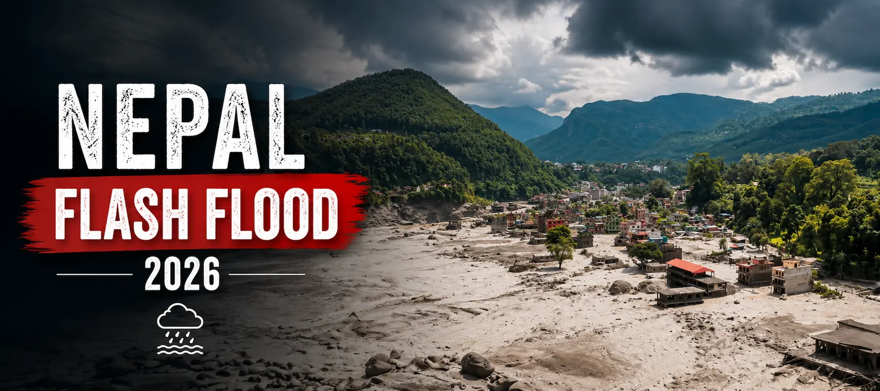
On the morning of August 26, 2026, Nepal was struck by one of the deadliest natural disasters in its recent history. A wall of mud, ice, and water thundered down from the mountains along the Nepal-Tibet border, tearing through villages, roads, and hydropower stations before anyone had time to react. This blog breaks down everything currently known about the Nepal flash flood 2026 — what triggered it, which regions are affected, the human and infrastructure toll, and what it means for trekking in the Himalayas.
Early evaluation indicates that the disaster started with a glacier failure in the mountains close to the China-Nepal border that caused a large landslide. According to the U.S. Geological Survey, the collapse was an earthquake with a magnitude of about 5.2, and a separate magnitude 4.4 shake was also felt earlier in the morning near Kathmandu, about 100 km north of the city.
The landslide released a huge quantity of rock, ice and debris into the upper Bhotekoshi River that rises on the Tibetan side and runs into the district of Rasuwa in Nepal. This mass of debris turned into a sudden flash flood and whizzed downstream with little warning. There was no significant rainfall in the area at the time, supporting a strong case for the event being of glacial or landslide origin, rather than from monsoon rains, said local officials.
The flood gained additional momentum and strength as it rushed through narrow mountain valleys, crushing the bridges, washing over multi-story buildings, and drowning those who could barely escape. The water combined with the larger Trishuli system by afternoon effectively spreading destruction downstream.
The Nepal flash flood 2026 has hit a wide stretch of territory along the Bhotekoshi-Trishuli river corridor. The most severely affected areas include:
Authorities have urged residents in all five downstream districts to move away from riverbanks and low-lying settlements as search and rescue operations continue.
The human cost of this disaster is severe and still climbing. As of the latest updates:
The infrastructure damage is equally extensive:
For anyone with travel plans in Nepal, this is one of the most important parts of the story. Syabrubesi is the standard starting point for several popular treks, and thousands of trekkers were reportedly on these routes when the flood struck.
The trekking regions currently affected by the Nepal flash flood 2026 include:
Nepal’s Tourism Board has asked trekkers already in the region to stay in safe locations, avoid riverbanks, and follow instructions from local authorities. Anyone with an upcoming trip to Langtang, Gosaikunda, or the Tamang Heritage region is strongly advised to check directly with a registered trekking operator before departure, since road access and trail safety are still being assessed.
The number one question being asked right now is: it depends on where you’re going? And that’s a true statement.
Kathmandu and most of the country remain open and functioning normally. The disaster has been restricted to a specific corridor, the Bhotekoshi and upper Trishuli river valleys in Rasuwa district of the country. This event has not affected everyday travel, sightseeing, and business activities in Kathmandu Valley, Pokhara, and in southern Nepal.
However, caution is strongly advised in and around the disaster zone:
If you plan to trek to Langtang Valley, Gosaikunda or the Tamang Heritage Trail, you may consider postponing your trek until the route is opened by a registered trekking agency or the Nepal Tourism Board. Other major trek areas (Everest (Khumbu) and Annapurna) are not affected and are functioning normally, and may be considered if there is some flexibility in the trip.
For trekkers specifically: if your itinerary includes Langtang Valley, Gosaikunda, or the Tamang Heritage Trail, treat your trip as on hold until a registered trekking operator or the Nepal Tourism Board confirms the route is clear. Other major trekking regions — such as Everest Trekking Region (Khumbu) and Annapurna Trekking Region — are not part of the affected corridor and are operating normally, making them reasonable alternatives if you have flexibility in your plans.
In short: Nepal as a whole is safe to visit, but the specific area around Rasuwa and the Nepal-Tibet border should be avoided until officials confirm it’s stable. Always check the latest advisories from Nepal’s government and your home country’s foreign travel advisory before finalizing plans.
The scale of this tragedy is a huge number and reminder of how vulnerable Himalayan communities and trekking routes are to sudden glacial and landslide-driven disasters. As rescue operations continue and the death toll is expected to rise, the priority remains locating missing persons and restoring access to isolated communities. Travelers planning treks in northern Nepal should stay updated through official government and tourism board channels before making any travel decisions.
Contact Alliance Treks and Expeditions for Tours and Trekking in the safest destination for travel.
Contact Us
Alliance Treks & Expedition Pvt. Ltd. Once is not enough for naturally and culturally Himalayas